| A
Norwegian Cruising Experience Ralph Roberts, Wilhelm Munthe-Kaas and Blunderbus (W1309) explore some islands off the coast of Norway just south of the Arctic Circle in mid-July 2002 Part 3 of a log by Ralph Roberts .. |
|
Day 9: Træna
The
next morning dawned bright but the people running the local community
centre
had given us a forecast of rain later in the morning. Wilhelm, Ole and
Torunn
set out to climb the highest peak, whilst I decided on something less
ambitious
by visiting a large cave we had seen, and climbing the lowest of the
three
mountains.
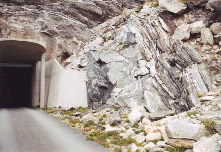
I set out along the road through the community of houses around the harbour, before following a well worn path to the natural cave known as Kirkhellaren – the natural cathedral. And pretty impressive it was, too. A geological fault line in the rocks had created horizontal rock formations on either side, with a vertical formation between. The collapse of the lower section had led to a cave being formed that is 32m high, 20m wide and 45m deep. It is an ancient site, with remains dating back 9000 years. Walking back along the grassy shoreline, I came to a footpath with steps and a rope handrail leading to the top of the lowest peak. I still found it hard work to reach the top, and it was only Wilhelm’s desire for me to see the view from the top of a mountain in the area that gave me the resolve to keep going. The view however was certainly spectacular, and well worth all the effort. 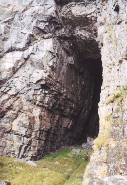 Kirkhellaren,
a natural cave, the size
of which can be judged by the people on the right, near the
entrance.
 The
entrance to the tunnel made through the central mountain, revealing
some very intricate rock formations.
A tunnel had been carved through the
adjacent mountain during the construction of the radar station. I
decided to
take this easier route down, as the lower entrance on the other side
was only a
short distance from our camp. I had no torch, and there was complete
blackness
after the first 100m. It needed a steely determination to continue
walking
blind, with hands outstretched to touch the walls before I stumbled
into them.
It was just about the scariest thing I have ever done. I could
literally feel
my hair standing on end! The supposedly 700m length of the tunnel
seemed more
like 7 miles, and it was with great relief that I saw a speck of light
finally
appear.
I met up with the others on my
return to our camp. They had been forced to give up their attempt to
climb to
the top of the highest peak as it was too difficult without specialist
climbing
equipment. The rain started soon after that and continued heavily for
the rest
of the day, so we decided to stay put rather than move on. The local
Community
Centre provided us with some of the best hospitality possible in these
not so
pleasant conditions. We were invited to dry any of our wet gear, enjoy
the
luxury of another shower, and even offered an excellent meal when they
had
overestimated the food needed for a group of other guests.
... |
|
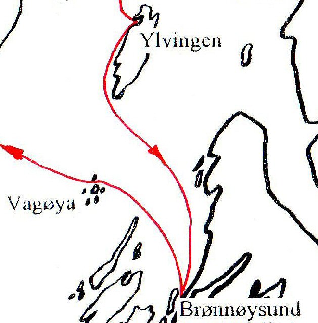
Day 10: Træna to
Alstadhaug
The
next
morning was still wet and also very windy. But with conditions
brightening, we
decided it was time to start our return to Brønnøysund.
The weather certainly
wasn’t suitable for Ole and Torunn to set out though, and we learned
later that
they had caught the ferry back to the mainland. We set off under reefed
main,
and once clear of the protection of the islands, also changed down to a
small
jib.
 We
sailed reasonably comfortably closehauled for the next 7 hours to
clear the southern point on Lovund, and on towards the large offshore
island of
Dönna. It proved to be a long, wet sail, with a regular amount of
spray coming
over the gunwale and we were pleased to reach shelter behind the island
of Vandoed,
where we stopped for an hour’s
break and a change of clothes.
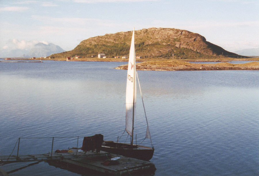 Taking
a break in the lee of the island of Vandoed. The much larger island of
Dönna is in the background,
with the mainland mountains covered by cloud beyond. 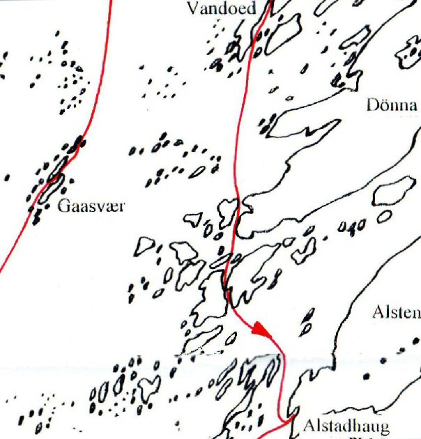 The
wind dropped significantly
whilst we were on Vandoed, but we decided we needed to get closer to
Brønnøysund before
stopping for the night. After setting off around 2130, we soon had to
use
the motor
to make reasonable progress. Weaving through the channels between the
islands
on the southern tip of Dönna would have proved an interesting
challenge, had
Wilhelm not previously sailed the area so that he knew the route. We
passed
under a number of bridges linking these islands to Dönna, and it
was obvious
from the large houses and expensive motor boats, that this was quite an
exclusive place for people to live. It was getting quite late by now,
and we
were both tired from the day’s sail, but there didn’t look to be
anywhere
particularly convenient to land where people wouldn’t mind us setting
up our
tents. We eventually decided to continue on to Alstadhaug on the
southern tip
of Alsten, but with no wind, it proved to be a long three-hour motor
before
we reached our destination. We
finally tied the boat up to a wooden jetty at 0230, just as the sun
was
beginning to rise again. The tents were quickly put up and we readily
collapsed
into our sleeping bags.
|
|
Day 11: Alstadhaug to
Ylvingen
Alstadhaug
is well known in
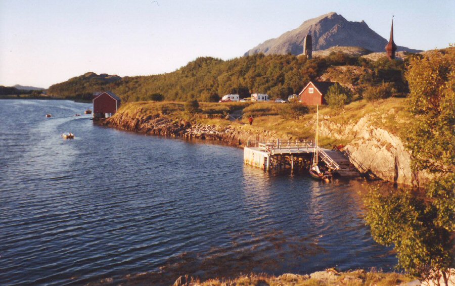 The
graceful steeple of the old and
elegant church, with a pillar nearby to
commemorate the life of Peter Dass.
The first of the seven sisters mountain range is in the background. 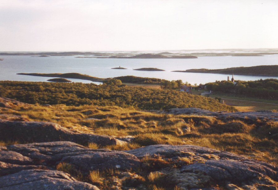 The mass of islands
offshore seen from a low
hill above the church, the spire of which can be seen to the right of
this
picture. The graveyard adjacent to the church
contained some very elaborate
headstones.
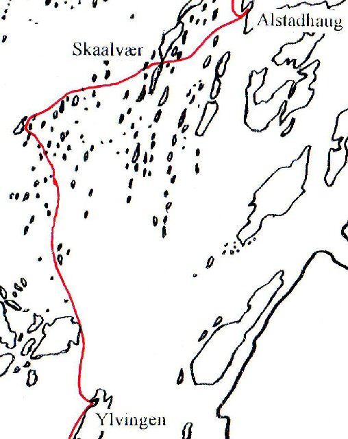 As
we set off, the
day
was still bright, with a pleasant breeze
now veered to the north-east.
But the forecast
indicated deteriorating
weather conditions, with gales expected in a few days' time. Wilhelm
decided
to make the most of the day’s good weather by sailing through the maze
of
islands immediately offshore, before stopping for the night somewhere
within
easy reach of Brønnøysund, just in case the weather
worsened earlier than
expected.
After
starting out around mid-day, we stopped shortly after 1600 for a break
on one
of the larger islands. It had a local shop within reasonable walking
distance,
and as we were running out of some food items, including cans of beer,
Wilhelm
decided it would be worth the trek. Unfortunately Wilhelm arrived too
late to
be served alcohol, and even his query “Are you sure it is after 1600?”
(it was
at least 1645), only got the shopkeeper to hesitate for a moment
before
deciding that it was indeed past the time he could sell cans of beer.
Perhaps a
local person might have been given preferential treatment!
As we continued to weave our way through the
islands, we hit our first rock - in the middle of a
relatively open stretch of water, just to remind us that not all the
rocky
outcrops were above the surface, and visible. Fortunately it was only
the
centre plate that made contact. By early evening we were immediately
north of
Vega, and though our general position was easy to determine from the
island’s
prominent mountain, exactly which particular islands we were sailing
past would
have been impossible to ascertain without the GPS. Rounding the
north-east
point of Vega, we made for the island of Ylvingen (Wilhelm eventually
had to give
up trying to get me to pronounce this correctly!) and stopped for the
night in
a sheltered fishing harbour, tying the boat up between two wooden
fishing
jetties.
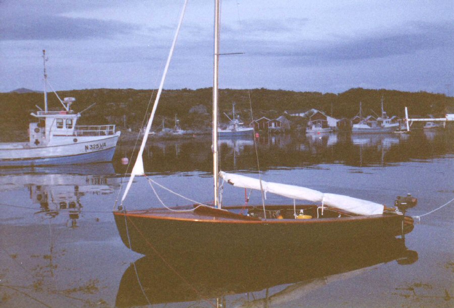 The
jetties to which Blunderbus is
tied had no access along the side of the sheds to the shore. This was
very
useful for security, but made it quite difficult for us to moor the
boat in
deeper water, whilst still being able to gain access to it.
|
|
Day 12: Ylvingen
to Brønnøysund
It
was
evident the following morning that the weather was on the change as
there was a
blustery southerly breeze and intermittent showers. We were visited
fairly
early by one of the fishermen living in the small town opposite, as we
were
obviously camping on his property, but he proved to be very friendly
and
helpful when Wilhelm chatted to him about our cruise. We then made a
short
visit to
the harbour area of the town before setting off around mid-morning for
the last
day of our memorable cruise, which entailed a relatively easy ten-mile
beat back
to the marina and launch site at Brønnøysund.
 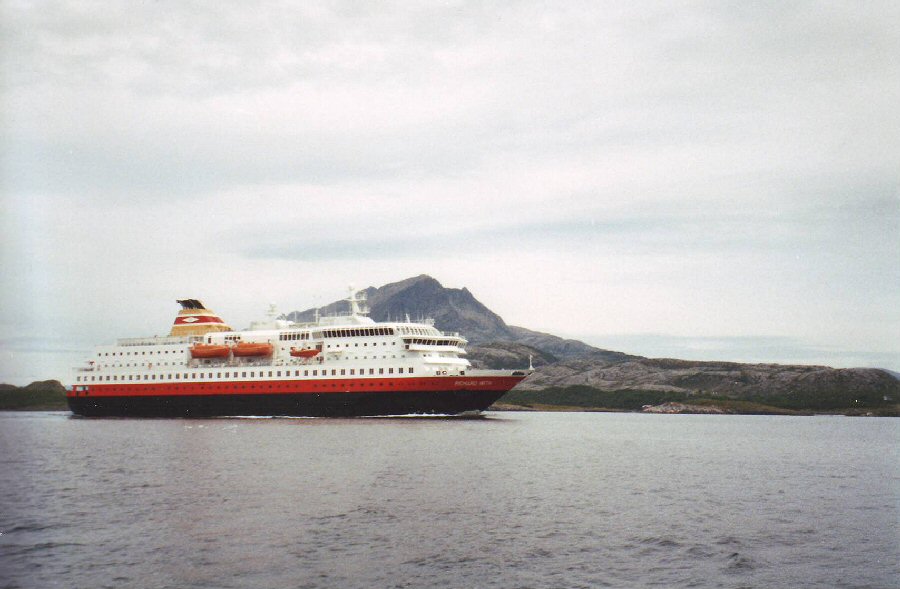 After rounding the southern point of
Ylvingen, we sailed closehauled towards the mainland, crossing the
main
deep-water route along the Norwegian coast. A luxury liner (above), one of many
that
cruise the coastline and fjords, passed fairly close by. We were
dressed up in
our full sailing gear and one could imagine the cruise passengers
looking out
at us from the comfort of their temperature controlled lounges, perhaps
even
taking pity on us ‘poor wretches’.
However,
we had no desire to change places
with them - well, perhaps the shower and toilet facilities might have
been a
slight temptation! But even these comforts weren’t worth the handicap
of only
being able to look out at the magnificent scenery from a distance, and
often
behind
the barrier of a glass screen. Stopping at one of the main ports for
some
‘retail therapy’ and possibly meeting a few ‘local people’ dressed up
for the cruise ship's
arrival was a whole world away from our experience of seeing the
magnificent
scenery from a much closer viewpoint, and meeting real local people
with their
very generous hospitality.
... |
|
Epilogue
Our
cruise had been given us a chance to encounter at first hand
the true
environment of this part of Norway. We had been able to stop at any
point we
wished, and
get much closer to the wonder and majesty of the landscape. The trip
would
perhaps have been even more magical, had we been able to continue on a
northerly course from Træna. This would have enabled us to cross
the Arctic Circle,
explore one or more of the
fjords in greater depth, and hike to the Svartisen glacier, which comes
within
a few miles of the shoreline at one point. Unfortunately this was not a
practical option, but is always something one can look forward to
experiencing
another year. In fact, one could spend years cruising the Norwegian
coastline
and waterways, without ever losing the desire to go back for more.
Ralph Roberts W9885 (but sailing
W1309 Blunderbus, for this trip)
|
| return to this log's
index return to Cruise Logs index |