September 2004 Cruise
Tom Graefe
Wind, Fog and the Wondrous Maine Coast
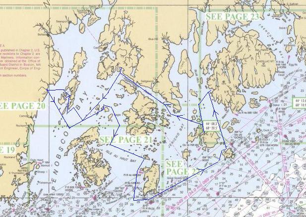
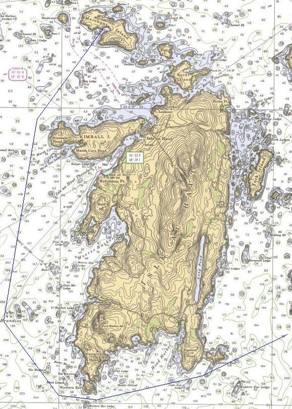
Charts of the Maine coast are endlessly interesting. The many
miles of shoreline and islands and inlets create an engaging tapestry
of geographic features, shown in the man-made two dimensions. In
September of 2003 Dick Harrington and I had cruised for a week starting
in Muscongus Bay and heading north and east towards Vinalhaven.
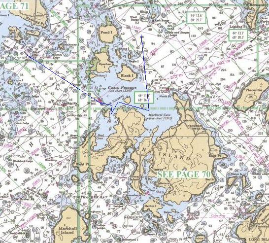
This year we were starting on western Penobscot Bay and
continuing east to Mt. Desert. After Dick and I had outlined the
gist for our second cruise together the charts came alive with
interesting places to see and to sail Blue Mist. Cruising guides
only scratch the surface of possible exploration available to a larger
craft, let alone a Wayfarer that can go just about anywhere you have a
foot of water. In Frenchboro, on Long Island, we were
invited for coffee one morning aboard a classic 1950's wood ketch
sailed by a retired instructor from the Wooden Boat School and his
companion. Over a fresh-brewed cup of coffee, we chatted for a
while about where we had been and were going, and their sailing in the
area past, present and future. It was a relaxing time with
camaraderie quickly found among kindred spirits, though he felt more
'admiration than envy' of dinghy cruising. Along the way he told
us how, after recounting to a friend the story of his trans-Atlantic
voyage, his friend, a native Maine resident, commented by asking "why
did he need to do that, when he could sail the waters of Maine for 50
years and still not have seen all the places there are to see."
I imagined the Maine twang with intrinsic skepticism, part
wry humor and part truth echo in that comment. So it was after our week
sailing we had covered quite a few miles, but left many passages and
anchorages for the future.
We started and ended at Lincolnville, Maine, just north of Camden. Lincolnville is a small town, whose primary feature is probably the landing for the ferry to Isleboro, a cluster of islands which lie a couple of miles the east. There are a few shops and a restaurant, called, what else, the Lobster Pound. While planning the cruise I had phoned and spoken with the harbormaster, who referred me to the owner of the Lobster Pound as an option for parking if the state ferry lot was full. The owner was friendly over the phone and suggested we stop by when we arrived. So after reconnoitering the put-in we went to have lunch. The fish sandwiches were good as only really fresh fish can be, and once we passed muster, the owner was kind enough to provide us a free place to park where the ferry lot would have charged $15/day. There is a good ramp and dock available, with little traffic even on the Saturday before Labor Day. While rigging we encountered a returning Sea Pearl (two masted 21' cruising boat) being taken out after a week cruise, which was the first sailing endeavor by two kayakers. There were several other kayakers that decided to take the ferry due to the wind and whitecaps.
It was a sunny day with some cumulous clouds, showing white to offset the pretty blue sky. The wind was blowing strongly from the north/northeast. In fact it was enough wind to bring up plenty of whitecaps on Penobscot Bay, as we looked over to Isleboro. The night before we talked about the trip, where we wanted to go, places we might try to spend the night at, harbors to visit. It all depended on the wind, how much? Which direction? Too much or too little? The familiar sailor's refrain.
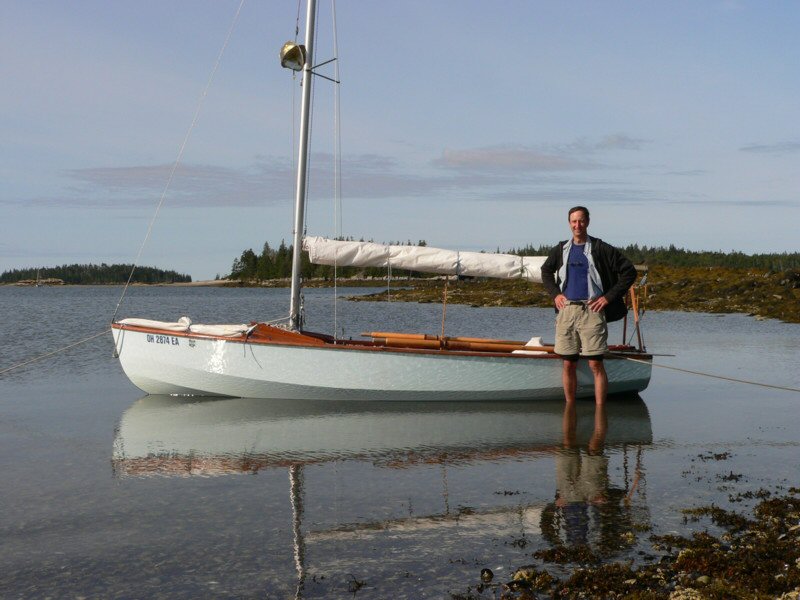
Finally at 3:00 PM Blue Mist was packed-a week's food and gear and the two of us-launched and ready to go. We looked again at the waves, felt the wind and discussed what the open areas of Penobscot Bay would be like, especially as we headed across to our intended anchorage on the east side-about 15 miles away. We estimated the wind to be around 20 knots-certainly more than ample for our purpose. We decided on one reef in the main and the small jib. Foul weather anorak top, but only lightweight waterproof pants. I anticipate the cruise finally starting, and the afternoon and the week ahead. The water in the bay is in the upper 50's, and we do not want any mishaps. I am confident, but also can imagine possible problems and their consequences. This bit of anxiety sharpens and tunes my senses to the unpredictable. As we reach south/southeast to get around the southern tip of Isleboro, and onto Penobscot Bay proper, the waves get bigger. The wind is mostly steady, driving Blue Mist, but with periodic gusts the boat surges ahead. Though fully loaded, we are really moving. Dick tests out his GPS and finds we are pushing 6 or 7 knots, telling us what we already knew, that we are covering ground at a good clip.
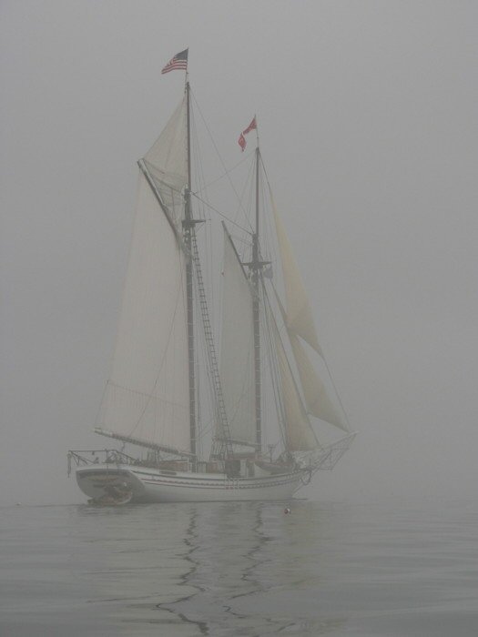
What a great start! What a day! I watch and feel the wind: What is it doing to the tell tales? How does it shape the jib and the mainsail? What does the surface of the water look like, near and away? Are there ripples on the waves as a gust moves towards us? Where does the wind touch my cheek or my neck? Is the boat balanced? We are in a groove, and the boat surges with another gust, lifting us up on the waves, and passing from the sails through the hull to the tiller to me. The water sparkles. The questions go away. I move the tiller slightly towards me or away to match the rhythm of the waves and stay on course. My body sways forward and back and I get in tune with Blue Mist. Time passes and we continue on our reach towards Vinalhaven, and then decide to turn northeast to the Barred Islands for our evening anchorage. At first it seems the wind eases slightly, but then it settles into a pattern of picking up and slackening, at 15-20 knots, sometimes more. But now we are beating, and so spray is coming over the bow. I feel the nap of the main sheet in my hand, between my thumb and forefinger, as I ease and harden the sail. There is a different rhythm of tiller changes, from guiding the boat as we move with the waves abeam and off the rear quarter, to adjustment and compensation to keep the boat level and powered up as we head more directly up wind. I adjust my rear end over the gunnel and hike out a bit more, sometimes feeling the waves hit me. Blue Mist sails well, but I realize I have been gripping the tiller extension hard. A couple of hours of sailing in these conditions leave my hands slightly cramped. We are enjoying the wind, relying on the wind, being careful of the wind. It is the perfect place to be-at the center of the wind and waves, and the hull and sails.
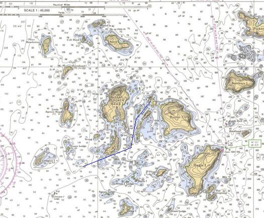
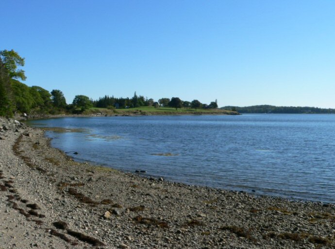
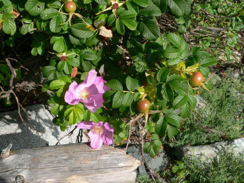
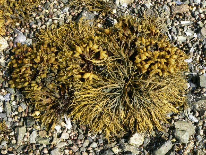
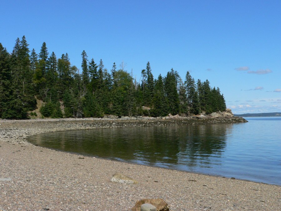
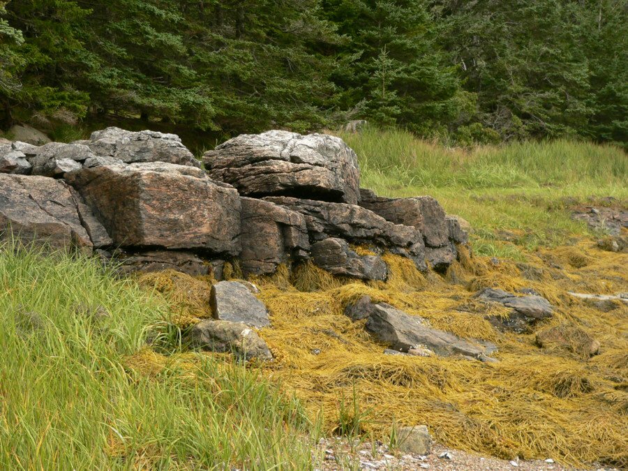
The Barred Islands are a small archipelago situated between two larger islands-Great Spruce Head Island and Butter Island. The natural beauty of the Maine coast is found in large and small scenes. Sailing in a Wayfarer affords the chance to feel both the sweep of scale and the intimacy. Because the wind was blowing strong from the North we were concerned the north-south lying archipelago would not offer enough protection from the wind and waves. We rather anticipated an evening like that we had last year at our first night at Harbor Island-strong cool winds and quite a bit of motion. As we beat up wind into the group, which covers about a third of a mile, we could see a larger island to the west, a small island at the head of the chain in the north, and next to this another small island on the east. We sailed past one larger boat and continued further until we were able to anchor 50 feet from shore, with Blue Mist nestled in a beautiful curved cove in the lee of this northernmost island. The neighboring island was smaller, nearly barren, and populated with several sheep. We realized as the tide dropped that the islands were connected by a large shoal (ahh right, as in Barred Islands), and Blue Mist was protected from both wind and waves in her anchorage. There were perhaps 4 or 5 feet under the boat at low tide, and from the water's edge to the tree-line the shore was the rubble of rocks and seaweed, colorful in their shades of green, gray, tan and brown. At the edge of the forest were bushes of wild roses and other flowers and above them stood the more stately pine trees so characteristic of the Maine coastline. This was the sight so near at hand when we opened the boom tent the first morning.
The winds had shifted to the southeast and then died as we sailed from the Barred Islands around Butter Island. So we went ashore to wait out the lull and talk to a kayaker that had spent the night there at a Maine Island Trail campsite. The Maine Island Trail is a 325-mile long waterway extending from Casco Bay to Machias Bay, championed and maintained by the Maine Island Trail Association and its members. After this brief stopover the wind picked up to 10-15 knots and we sailed south down East Penobscot Bay on a long tack taking us towards Fox Island Thorofare on Vinalhaven, before we tacked across to Merchant Island on the west side of Merchant Row. We hove-to off of the entrance to Deer Island Thorofare for lunch, and then headed towards Isle au Haut. In the declining wind we sailed into a cove on the west side of Merchant Island, rather than pushing on into the evening.
Pictures from Butter Island

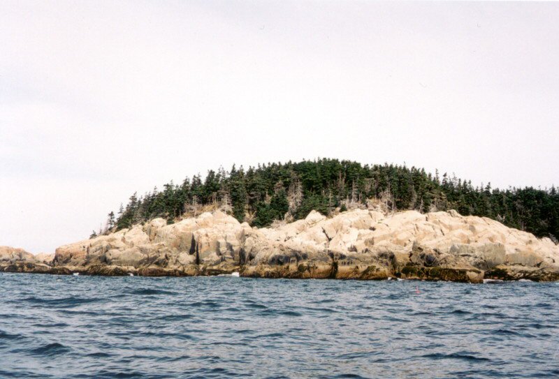
On Monday, in another sunny morning, we left Merchant Island in a gathering southeast wind of about 15 knots and sailed down the west coast of Isle au Haut, passing the Brandies shoals and then around the Western Head and it's extension, the Western Ear. At the shoals we had a chance to see seals lounging on the rocks.

A look at the topology of Isle au Haut shows the relief of a shore that reaches nearly 200 feet above the water. The orange tinted gray-white granite heights offset by the crashing white breakers below and the pine trees above were entrancing. I would look away and check the sails and then look back. I felt suspended by the sight and did not want to miss a moments chance to absorb it.
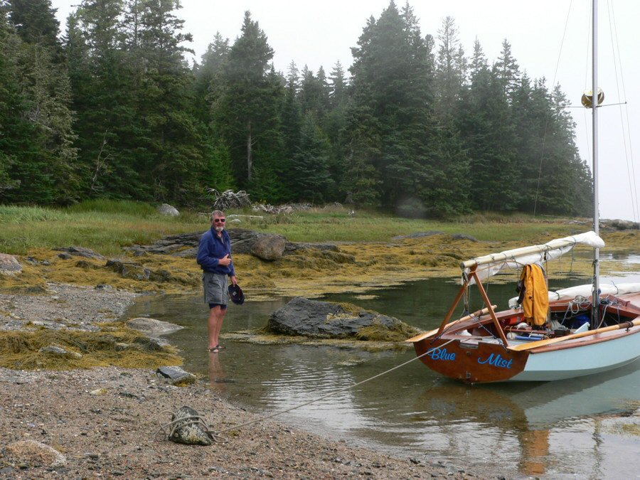
We continued sailing more easterly, passed the Eastern Head and then set a course to Long Island about 15 nm away to the east-northeast. We passed Black Horse and White Horse Islands, each showing their respective colors, and then Great Spoon Island (it must be its shape, as seen from above) and continued on to Frenchboro on Long Island. The wind was steady and we carried on with a moderate ocean swell.
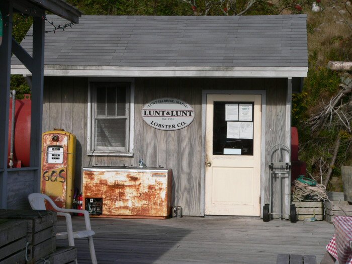
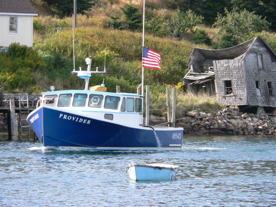
We sailed into Lunt Harbor, in the town of Frenchboro late in the afternoon. The outer harbor had several larger yachts at anchor, while the inner harbor was filled mostly with lobster boats. The shores are lined with houses or remains of houses from many generations. Frenchboro nearly ceased to be a town several times in the 200 or so years of its existence. The latest crisis was solved in the mid 1980's when a state block grant enabled the town to make cheap land available to 'settlers' willing to come to the island and take up lobstering and fishing and reside there. This small lobstering community on Lunt Harbor is the only town on the 2500 acre Long Island. Lunt harbor, so named after one of the original settlers, is home to Lunt & Lunt dock, lobster pound and deli-the only commercial establishment in the harbor.
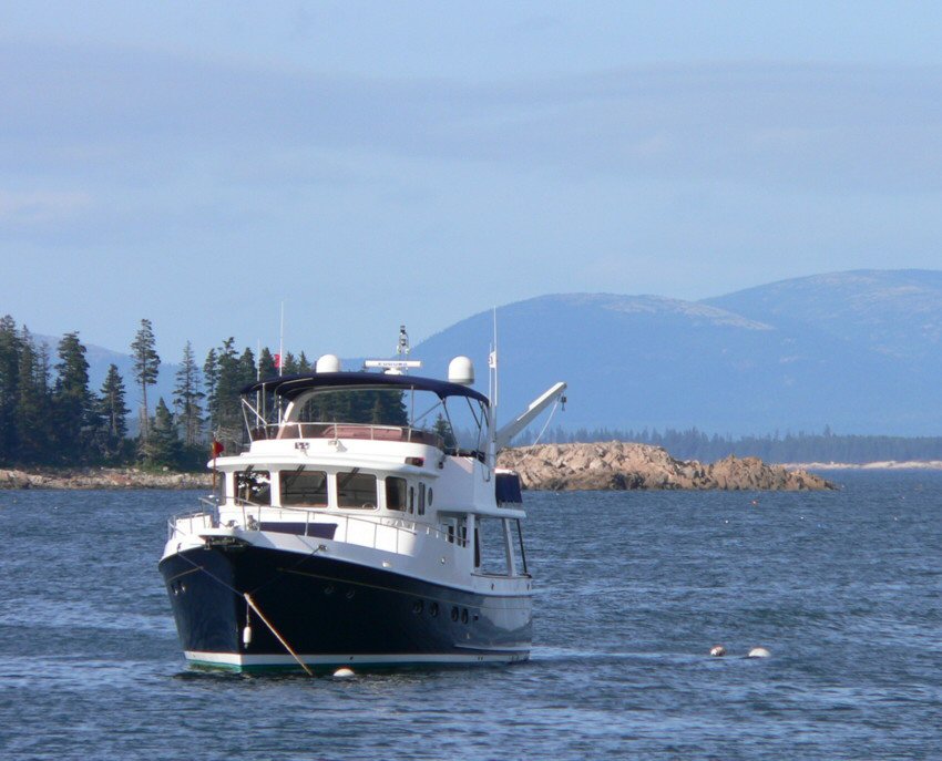
After landing at the town dock we strolled down the road by the harbor and fell into step besides two couples just returning from a walk in one of the nature preserves on the island. As we were all going around the end of the harbor and over to the opposite side to Lunt's deli, we enjoyed the sun and chatted about our respective travels. They were a couple with friends, who had been up the St. Lawrence and were heading down to Annapolis. While we were only three days scruffy, they were Northeast Harbor outfitted. We got a look at their yacht once we reached the far shore and looked out on the largest anchored boat in the harbor. This is pure Maine cruising, where you can go from lobsterman to kayaker to the epitome of posh cruising. We also met a crew of Germans chartering a sailboat, and retired couple-ex-sailboaters, now powerboaters who owned a very nice 40+ foot Eggharbor.

From Frenchboro we left in a morning fog and sailed north up the western coast of Mount Desert to Seal Cove, about half way up, passing between Swans Island and Placentia Island as we proceeded up Blue Hill Bay in what turned into a sunny afternoon. Seal Cove was the place where my wife Nel learned to love the Maine coast as a child. Her family spent many summers at a friend's camp there. Sure enough there was the concrete salt water swimming pool where she learned how to swim, and the shore line she spent hours walking in her private aquarium. She has been trying to get me to visit Mt. Desert and see Seal Cove for years, and now here I am.
Clouds moved in as we left Seal Cove and sailed west across Blue Hill Bay between Bar Island and Trumpet Island, and then southwest towards Swans Island. We passed Casco Passage and looked for an anchorage we had been told about in Mackerel Cove. It did not seem suitable for us, so we decided to head on to Buckle Harbor, just around the point. The wind picked up and became very gusty as we headed through a channel from Mackerel Cove around the northern end of Swans Island into Buckle Harbor. With a stiff breeze blowing we anchored and rigged for the night.
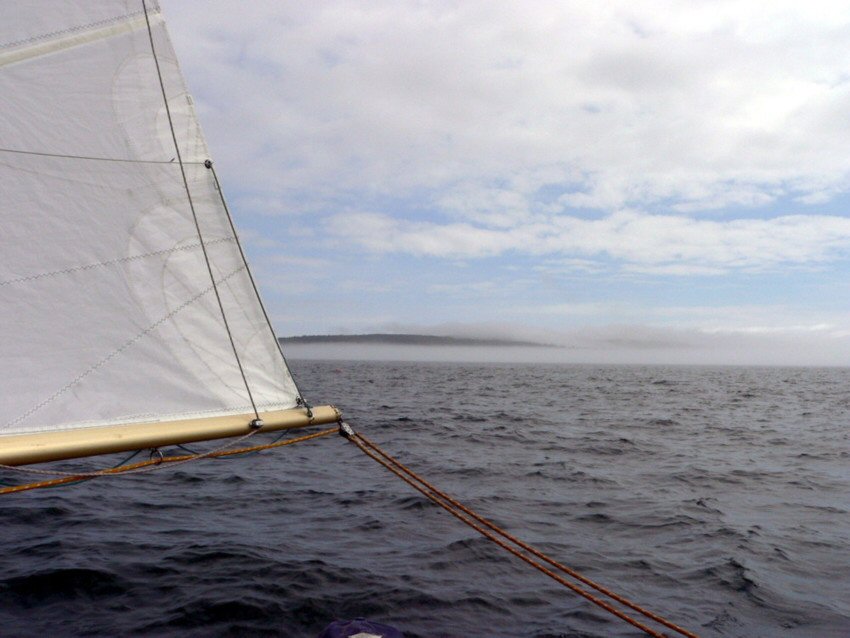
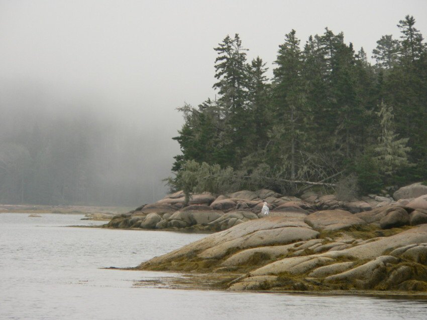
In a fog-filled dawn, the strong, gusty wind of the previous night was gone, replaced by the damp and placid surround of gray and muted tones. Foggy mornings cast the landscapes and water into a new edgeless relief. So it was here, as we sat in our still cloister. We left Buckle Harbor with light winds of about 5 knots and visibility in the fog just adequate to see the channel buoys about 100 yards away from our anchorage. We were planning to sail about six miles northwest to Brooklin, Maine, home of the Wooden Boat School. The course from Buckles Harbor to the western entrance to Eggemoggin Reach was straightforward once we were clear of the York Narrows, the passage we entered on leaving Buckle Harbor.
We passed by the red and green channel markers, alternately looking ahead into the soft grayness and watching the compass and sails. It felt reassuring to leave Swan's Island with a definite position, but the channel markers behind soon were clear only our chart, and otherwise but a memory, swallowed by fog and water. We were in Blue Mist and Blue Mist was moving, but progress was defined by the sense of motion and belief in the compass heading rather than any evidence around us. The wind lapsed and picked up a bit, but our progress became as a whisper in these clouds.
Into this vacuum, working Maine made its presence felt. As we made our way into Jericho Bay, we heard the lobster boats traveling to their traps. From one direction or another we would hear the rev of the lobster boat then the pause and then some minutes later the rev and so on in the rhythm of the lobsterman. We sailed slowly on, and my faint unease at being on instruments was replaced by speculating for a time on the chance of a Wayfarer-lobster boat collision. My mind wanders and rolls this question over, moving from anxiety to muse, until I reach for my usual remedy to like worries-and answer my question of 'what is the likelihood it happening?, with 'not very' and let it lie.
A blast from a compressed air horn sounds periodically to port, and some blasts later a 30 foot sloop appears motoring towards the Reach. The friendly captain alters course slightly to draw near us, and asks if all is ok, we say yes and he turns from us and continues his course. Sometime later we hear the short blast ahead, and so it goes. I mull over the admonition in various sailing courses that when underway in fog a sailing vessel must sound 3 blasts in succession (one long, two short) every two minutes, and realize that I have never heard anyone use the prescribed signals in the fog. I am glad I am not near any ferry or shipping lanes, and that we have a radar reflector. I doubt any lobsterman could hear a horn signal since they not only have a very loud engine but usually are working to loud rock music.
More time passes and off to one side maybe 50 or 75 yards away I glimpse a black shape appear at the surface and then disappear-a porpoise. Where to look next? Will the porpoise reappear? So far our only companions in the fogs have been a few seagulls and some water birds. Yes there the porpoise is again-and this time we both see it flash to the surface and disappear.
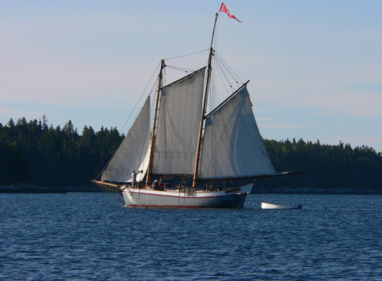
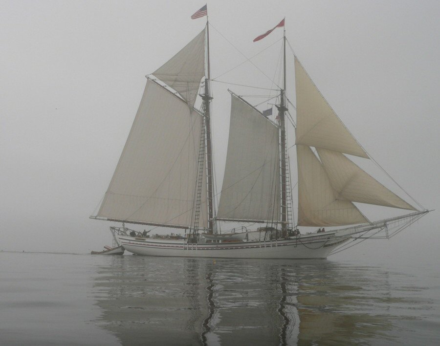
We stay on our course and every so often check the GPS as we move to the fairway buoy at the entrance to the reach. Then slowly out of the fog another sailboat appears. It is a wonder at first because it is a white windjammer, two tall masts, sails set, appearing out of the fog as silent as we are. Is it 2004 or 1904? We see the ship comes towards us and sails on, appearing and disappearing into the fog. And then we are in Grand Central Station-another Windjammer appears going east and slips by, followed by a sloop and then a small powerboat. Everyone wants to know where they are! You are here-RW 'EE' Bell.
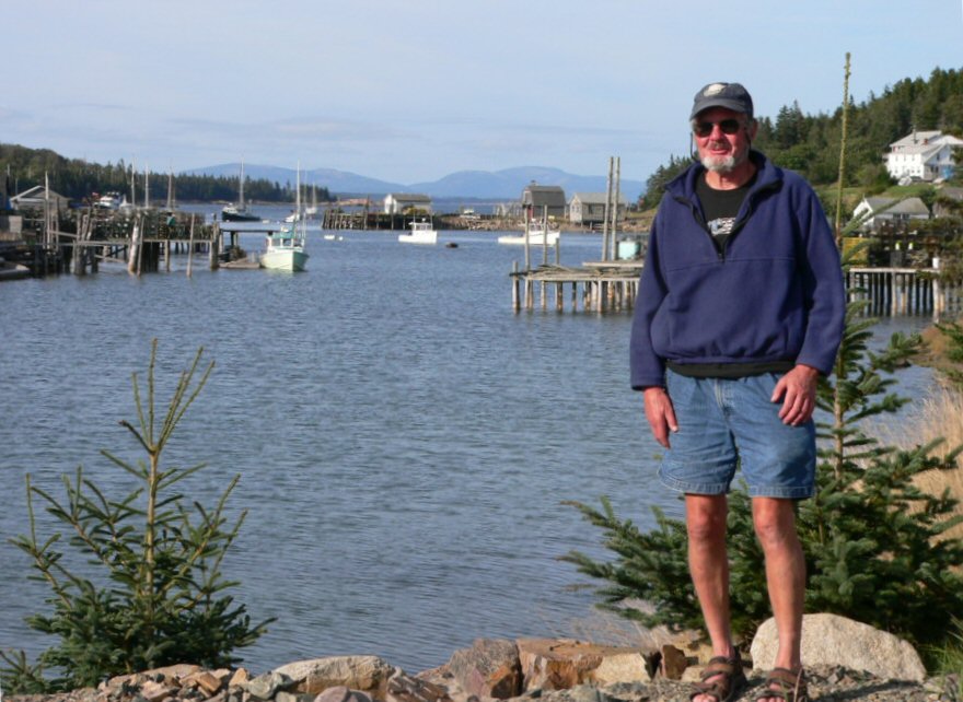
Eventually we head into the cove hosting the Boat School and all the variety of small and large wooden boats where we docked and eventually used a mooring for the night. While at the Wooden Boat School we met Frank Pederson, a resident who splits his time between Brooklin and the Chesapeake Bay region. He gave us a wonderful tour of the Brooklin boatyard as well as a smaller boatyard nearby where he had constructed his own boat. We also managed to clean up at the luxurious outdoor shower that had hot water-a pleasure after five days-included with the price of the mooring (whether normally listed as such or not!)
The foul weather predicted from the remains of Hurricane Ivan, making its way from the south, showed itself in the morning as overcast skies and light fog. But the weather window projected the night before-morning hours prior to the bulk of the rain and gale-force wind hitting by mid-afternoon--appeared to be holding. After breakfast we plotted the course for the day and set up necessary waypoints. We put on foul weather gear from top to bottom and headed northwest with a building 15-20 knot breeze carrying us on a broad reach up Eggemoggin Reach. The fog lifted and settled leaving us with intermittent sight of the shores of the Reach and eventually the bridge ahead, the midway point in our sail. Winds steadily grew with stronger and more frequent gusts and so we reduced sail with one reef in the main. Blue Mist accelerated and the wind and conditions continued to get more exciting (deteriorated?). Rain squalls came on as we passed the bridge and headed the last several miles towards Buck Harbor. Each squall brought a wind-driven deluge at our backs, thoroughly soaking Blue Mist. We were drenched as we sailed into Bucks Harbor amid very gusty and shifting winds, landed at the Bucks Harbor Yacht club dock, happy to be out of the gathering storm.
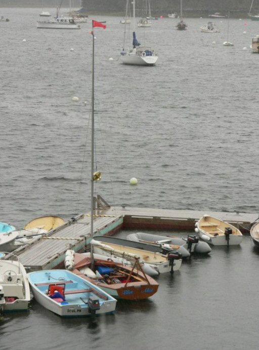
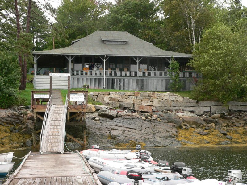
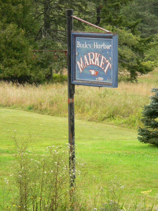
Bucks Harbor turned out to be true shelter from the storm. We settled Blue Mist in behind the dock amidst the dinghy fleet serving the moored boats. There were no signs of life at the yacht club, so we took some time to reconnoiter and then headed up towards the main road from the yacht club, and found the Bucks Harbor Market. Yes, another jewel in the middle of nowhere. From the outside it is an old building that has been recently painted, but with the tell-tale wear of old wood steps and large creaky floorboards that seem perpetually dusty. The market was a country store on one side, a small lunch area on the other and a bread bakery in the rear. What bread-several varieties of focacia, sourdough bread, and whole wheat bread. Definitely a blend of old and new, as cafe had a PC and Fax machine set up on a cardboard box--Buck's Harbor cyber cafe! We made it in time for lunch with 5 minutes to spare, were treated to home made cream of mushroom soup followed by fresh crab casserole. With our foul weather gear hanging on the chairs, we sat, dry, in the market and appreciated the warmth. In the slow motion of the still room we gradually passed from sleepy surfeit back to life. We made the five-minute walk back to the yacht club, and spent the rest of the day sitting on the veranda, reading, talking and admiring the storm from our dry perch above the harbor.
In the mid-afternoon a couple of members came by to check on their moored boats, and assured us it was fine to keep doing what we had been doing and take advantage of the deck and chairs. After we talked about where we had been, they asked where our boat was, so we pointed to the dock. They did a double take after which we affirmed it was the dinghy next to the other dinghies. They then invited us to sleep on the porch if wanted, saying they had been so accommodated many times by other yacht clubs and were happy to have us as guests. While somewhat enticing given the rain, we decided to have dinner and stay on Blue Mist.
That evening provided one of the more interesting mooring rides I have encountered. There was a very short line on the mooring, and so with the wind and water action Blue Mist skittered quickly back and forth in a 45 or 60 degree arc. The motion was fine, and it's relative naturalness a tribute to our adaptation after a week aboard, but it made hanging our backpacking lantern an adventure. The lantern hangs below the boom above the thwart, which is what we lean against for the evening. Normally as the boat swings gently to and fro the lamp may assume an arc of inches. But with the short tether of the mooring we were moving rapidly from one side the other, which set the lamp swinging in a quick and wide motion, right towards our heads. The joys of dinghy backpacking.
We woke to fog and clouds, which gradually cleared off by mid-morning with 10 knot winds from the south. After breakfast at our home-away from home in Bucks Harbor store, we sailed south west towards Vinalhaven, across Penobscot Bay. We were mostly beating across Penobscot Bay, hoping to have lunch in Pulpit's harbor, after which we would sail north several miles to Isleboro, roughly duplicating our original intended course a week earlier, but this time actually seeing Pulpit's Harbor.
We were about 3 miles out from Pulpit's Harbor when the wind began to pickup a notch to the 15-20 knot range with gusts above that. We put in one reef, and as the wind continued to build we dropped the genoa. We sailed past Grass Ledge and suddenly noticed a silver-gray shape popping up and out of the water. Sure enough it was a seal cavorting in the waves just off the ledge, while others lay on the rocks. We saw the seal dive and jump free of the water several times as we sailed by. We decided to head immediately towards Isleboro and our evening anchorage, as we anticipated the wind would continue to shift to the north/northwest, a change Dick noted is often accompanied by increasing strength. Indeed it did shift and pick up, so were beating in a strong wind now north/northwest to Isleboro. We were on a long northwest tack that took us roughly a third of the way up the Isleboro Island, the largest and eastern most island of the group, at which point we tacked and headed for the gap between Job Island and the southern tip of Isleboro Island proper, which was the channel we intended to take up into an anchorage for the night.
As we neared Isleboro the wind picked up in intensity by another 5 knots or so, and then as we neared the gap that was the entrance to the channel a series of gusts began to come at us-strong gusts funneled between the islands. You could watch them carry across the water, quickly rippling towards you and then slamming into the sails. These were not friendly gusts, but stronger overpowering winds that challenge you to find your way through, and which in a instant could have the boat over. We continue across the channel entrance and I sail just under the lee of the far shore and heave-to so we put a second reef in the main sail. Dick then takes the helm for our beat up the channel in search of an anchorage. As we make our way towards the Isleboro shore I see a couple of people standing idly on the shore watching. I have a pause and in my imagination see Blue Mist sailing, with firm ground under my feet rather than the wind-driven boat. The gusts continue and the waves build as we sail north between the two islands. Water spews over the bow as we catch larger waves which cascade onto the deck, hit the splashguard and shoot right onto my chest and face. The crew of a Wayfarer always performs this breakwater service for the helm. We are feeling a bit of adrenalin as we trade notes about the conditions and where we might find an anchorage, timing our tacks, working together to sail Blue Mist.
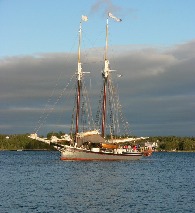
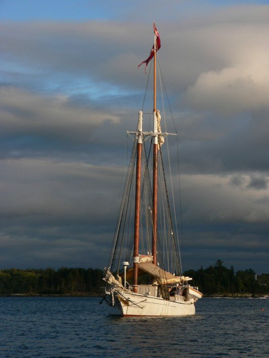
We look across towards the western most, Seven Hundred Acre island, and see two schooners anchored in a large cove on the southern side of quarter-moon shaped point of land. We wanted to tack and head right across, but we see there are intervening rocks, and so continue our wild ride north another 20 minutes until we can safely tack and cross, having nearly reached the opposite shore. We fly across and zip underneath the stern of one of the windjammers-a prior acquaintance from our night at the Wooden Boat School! When we finally set the anchor and dropped the sails I shake Dick's hand. Shipmates. We both breath in the stillness as we rig Blue Mist for the evening and enjoy a well-earned Guinness. Two more Windjammers join the assembly as evening sets in, providing fine company for our own classic Wayfarer.
So there we sat in the cockpit of Blue Mist, now dry from our pumping and sponging, enjoying our anchor dram and then our final supper of the cruise. The sun broke free of the clouds and lit the tops of the schooners and then finally set. After dusk someone on the Isaac H Evans started playing a fiddle, and then a guitar joined in. There must have been some talented crew and guests, because for the next hour or so we listened to old and new folk songs and shanties, harmonies and enthusiastic cheers waft over the water towards us. We reminisce about the recent summer rally and cheerful sing-alongs we had then, and as the music ends, lean our backs on the thwart, and relax to the sound of water rippling on the hull.
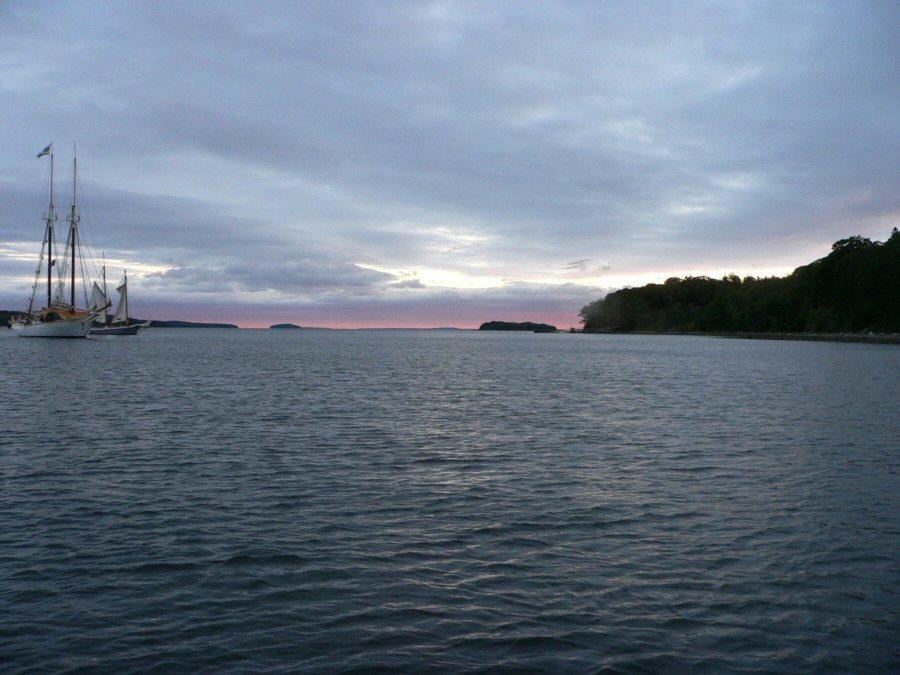
Saturday morning was a perfect bookend to the trip. Blue sky, building wind and wind jammers setting sail to wrap up their week, provided the backdrop for breakfast. We then sailed north and then west to return to Lincolnville and take out. As always the unpacking and de-rigging is the anticlimactic undoing of all our organizing and packing the weeks before. While we are still in the thrall of the cruise it is hard to believe the week is over. We have been lucky. While rowing Blue Mist to the ramp I talked with a fellow bringing his powerboat to the dock. He asked how long we had been out, and on hearing we had the last week, he griped that this had been the worst summer he could remember-cold and rainy-and that we had the only good week. I felt we had put it to use, and made the most of our opportunity to experience the range of Maine coastal moods. The charts had come alive with wind, rain, fog, wildlife, people and the wondrous coastal islands and shore.