| Cruising the Istrian Peninsula
of Croatia - 1 ... |
 click here for larger image ... |
|
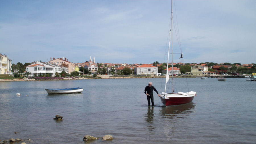
Our cruise started in Opatija,
on the north-eastern part of the Istrian
peninsula, just west of Rijeka. This part of Croatia was chosen since
it was not only the closest for Jacques Boirie to tow his boat from his
home in Lyon, but also useful for the retrieval of the car and trailer
from our start point. The shoreline around the peninsula stretches for
some 200 miles, whilst the distance by road from our start and finish
points (just north of Trieste) is only around 50 miles.
The initial plan had been to reach the southern point of the peninsula, and then make a decision as to whether to continue along the Istrian coast, or to sail around the islands of Cres and Krk, before returning to Opatija, depending on the prevailing wind direction. In the event Jacques was deterred from sailing around the islands before we set sail by the local reports of the very strong Bura wind, and a decision was therefore made that we would keep to our original plan of sailing along the Istrian coastline. 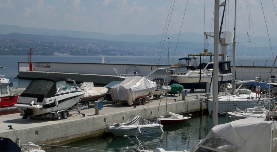 Jacques'
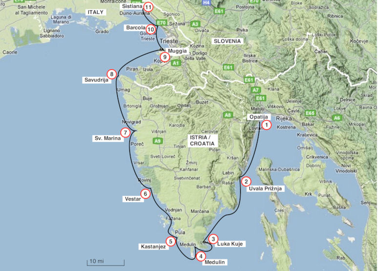
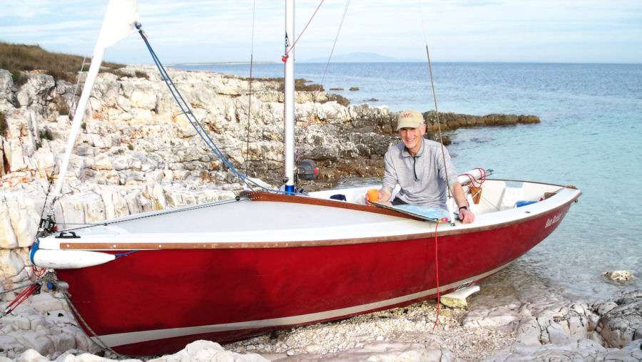
Wayfarer Sea Rocket moored
just behind the motorboat in the
marina in Opatija,
which proved a very convenient point to start our cruise. Packing of all the gear into
the boat took longer than had been hoped,
(which is usual for these types of trips!), and it was midday by the
time we set sail. We were blessed with a good gentle breeze however,
and we had an easy sail along the coast for the first few hours of our
cruise.
 Looking
back toward Opatija, where we had stayed for 2 days, thanks to
the very generous hospitality of Mato's* grandmother
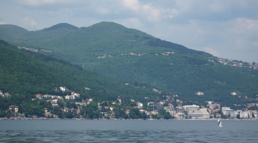
click here for larger image  Passing
a very elegant lookout tower on a promontory opposite the
nearby island of Cres
click here for larger image The topography of northern
Croatia includes a high coastal
mountain range, and this landscape has considerable influence on the
local weather conditions, The winds can change from virtually nothing,
to a very strong Bura wind
from the north in a very short time span.
It is this phenomenon that Jacques had been warned about, and exactly
what we experienced during the late afternoon of our first day's sail.
With few places to seek shelter, it provided us with some demanding
sailing.
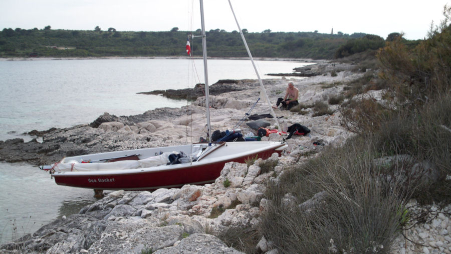
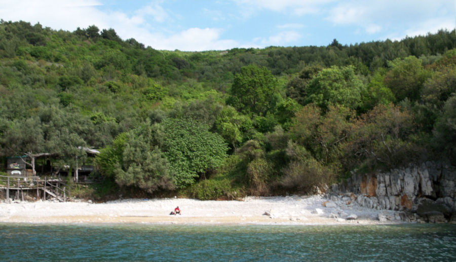 We
were moored on the far right-hand side, just out of sight in the
photo,
which was a very well sheltered spot when we moored the boat. 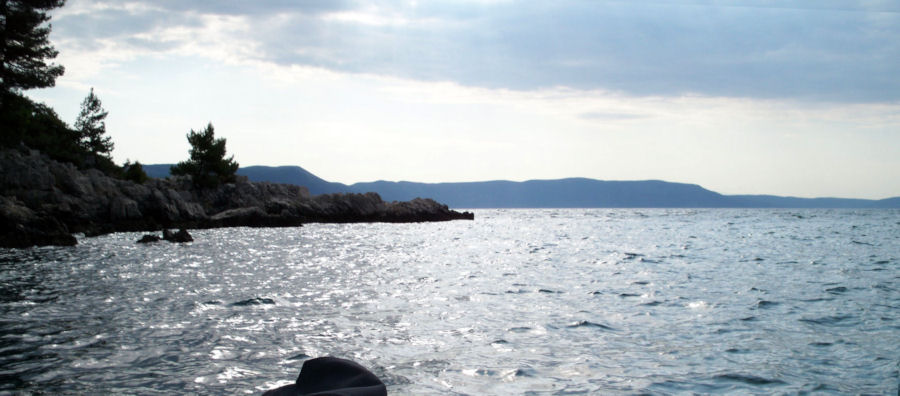 Looking
out toward the island of Cres, and the exposed area of sea,
which was the direction the wind blew in from during the night
A seemingly reasonably
sheltered anchorage for the night proved to be
less than adequate when the strong winds veered round 180° a few
hours later, and blew in from the exposed southerly position of our
anchorage. The line I had secured to the rocks fortunately held during
the night, but I was kept awake for some time by the movement of the
boat as it pulled alternately on the lines, and regretted that I had
not also laid a back-up anchor line off the stern whilst we had been
fully protected from the wind. A note was also made to include short
lengths of plastic pipe for future trips, to place over the mooring
line and prevent it chafing on the rock.
The coastline levelled out
after the headland at Crna Punta, two thirds of the way down the
eastern part of the Istrian
coast, which made the sailing considerably easier, as well as offering
a wider variety of places to shelter.
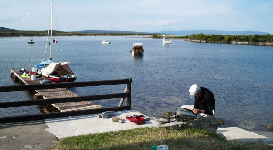
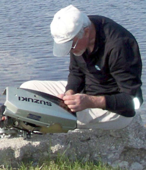
Jacques
working on the outboard motor after the mounting bracket had
broken whilst we
manoeuvered out from the bay of our previous stop, causing the motor to drop into the water. 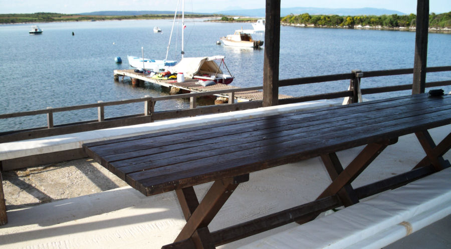 We
made full use of the jetty and covered eating area for our overnight
stop.
It was a real bonus to find such a perfect place to stop. 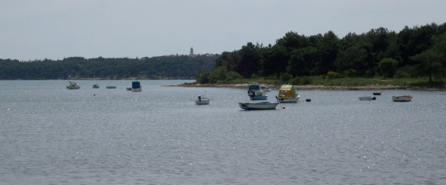 We
expected to be asked to move when the owners of the site came round,
but were only asked us to
tie the boat to the jetty supports, in case another Bura wind blew during the night. - click here for larger image After the very strong winds at
the outset of our cruise, we experienced
much lighter winds around the southern tip of the peninsula, even
resorting to paddling at times, since Jacques had been unable to get
the outboard working again. The southern point of the peninsula, proved
to be a more
interesting part of the coastline to sail, with its abundance of
islands, bays and inlets. We called in at the small town of Medulin in
order to restock with provisions and water. Whilst there, we decided we
had more than enough time to stop and enjoy a cool and refreshing glass
of beer in the local taverna.
 Mooring
the boat for a lunchtime stop at Medulin, it was easier to
anchor the boat in the shallow water shown,
than to use the crowded town jetty in the background. - click here for larger image 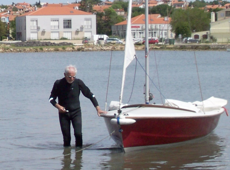 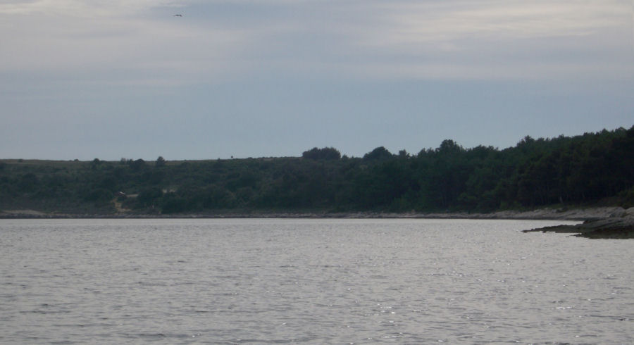 The
wide bay immediately opposite Medulin. Unfortunately the shoreline
was covered with sharp, jagged rocks, precluding any possibility of landing. Mato, my Wayfarer friend and
contact in Croatia, had introduced me to
the more recent GPS models which give an on-screen detail of the
coastline, as well the present position and course being followed. This
proved to be well worth the investment, and made the detailed laminated
chartlets Mato had provided me with largely redundant.
A large-scale road map of
Istria, enclosed in a transparent waterproof
case, gave an ideal overview for the navigation, and enabled me to see
where a suitably sheltered stopping point might be found for the night.
The GPS gave all the remaining information needed, as it was possible
to zoom in to give all the precise detail essential to navigate a small
boat into any anchorage.
Page 6 All we need now are about 2000 Roman slaves! This was Jacques comment as he surveyed the problem of getting his heavily laden boat up the shingle beach beyond the water line. Much of the Croatian coastline consists of jagged rocks, but at least here the rock was smooth. After our first night's experience, we felt it was a better option to get the boat ashore, even though this wasn't the easiest of places to do so.  There
was a convenient rock jammed into the base of the rock formation
around which we were able to firmly secure a rope to act
as an anchor point. The upper rope was used to hold the boat whilst the pulley rope was released and extended for the next pull. Using the well-tried cruising
technique of adapting the pulley system
of the kicking strap, and using fenders under the boat as rollers, we
were able to resolve the problem fairly easily on our own. Jacques was
quite impressed that by using some ingenuity and the
materials and detritus immediately around, setting the boat up for the
night ashore wasn't too much of a problem.
   Although
there are virtually no tides as such in the Adriatic, the rise
and fall of the water level
was sufficient for it to be necessary to support the keel of the boat at the stern. The historic town of Pula is
the principal town and
administrative centre for the Istrian region. It was to the south of
this town that we met up with Chris Ridley, who keeps his Wayfarer here
in order to sail in this fine location, and has all but completed the
mammoth task of restoring a holiday home to rent. His residence exudes
character, having been part of a cave in Roman times. Hence the name of
the property - Cave Romana.
 Chris
Ridley sailing out to meet us in the bay near his Istrian holiday
home at Vinkuran.
His mooring for the Wayfarer is only a short distance from his holiday home. 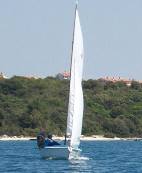 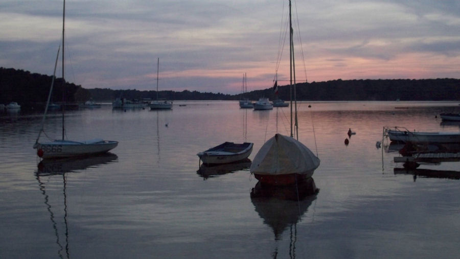 Sea Rocket and W8666 moored in the bay of
Kâstanjez, as ideal a
location as
you are likely to find anywhere in the world for sailing a Wayfarer. Chris had kindly offered us
accommodation in his holiday home for a two-night stopover. We used
this break in our cruise to visit a few of
the many sights the ancient town of Pula has to offer, including a
spectacular Roman coliseum, reputedly the 6th largest the Romans built
around their empire. Its size was truly impressive, and needs to be
seen first-hand to be fully appreciated.
We also made use of the
opportunity to carry out a few minor repairs on
the boat, such as getting the outboard bracket re-welded, so we could
at least carry the now defunct outboard on the back of the boat, rather
than storing it within the already congested interior of the boat.
Having survived on rather basic rations up to this point, we spent our
evenings enjoying fine meals in some of Pula's small restaurants.
The Croatian coastline has been
well fortified over time,
including defences put in place during the last World War. This made
for some interesting sights, particularly along the more exposed
western coastline of the Istrian peninsula.
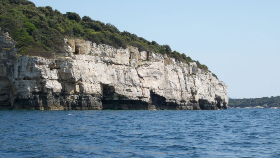 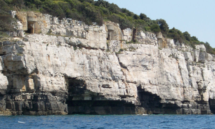 Very
well concealed, but just visible from sea level are the remnants
of the
World War II gun emplacements, at the top of the rocky white cliff. 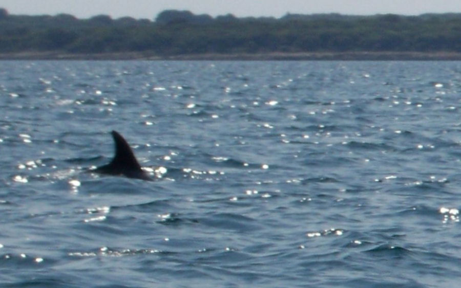 The
water of the Adriatic seems well able to support enough fish
to keep
both the predators, as well as the many local tavernas, well stocked. It was Jacques' wish that he
would see some dolphins on our cruise, and
the day after making this comment, we were lucky enough to come across
what we thought more likely to be a small whale, since it was swimming
in isolation. The picture above was taken off the group of islands
forming the Brijuni National Park, just to the north of Pula.
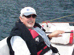 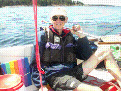 Jacques
(left), and Ralph
sailing in very relaxed mode -
something we were able to do
for much of the time in the near ideal conditions we experienced during our trip. |
| next page return to Cruise Logs index |