| Florida
120 May 14 -17, 2009 |
|
 I
picked up
Robert Mosher in Berrien Springs around five o’clock on
Tuesday, May 12th. We drove
until about midnight, stopping in Bowling Green, KY right next to the
Corvette
Museum. No time to take a peak however, as the next morning we were off early,
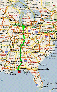
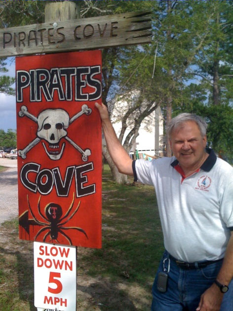
reaching Pirates Cove in Josephine,
AL around 4PM. 930
miles of driving! But we
were
both excited to be there.
... |
 Gary Hirsch 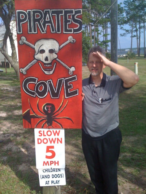 Robert Mosher 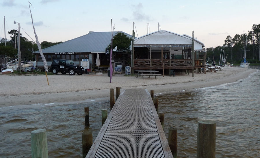 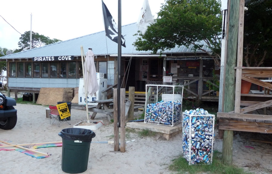 |
|
Day
1: Pirates Cove in
Josephine, Alabama to Sand Island, Florida
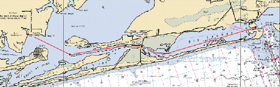 Day 1 & 4 = 12 miles x 2
Pirates Cove in Josephine, Alabama to Sand
Island, Florida
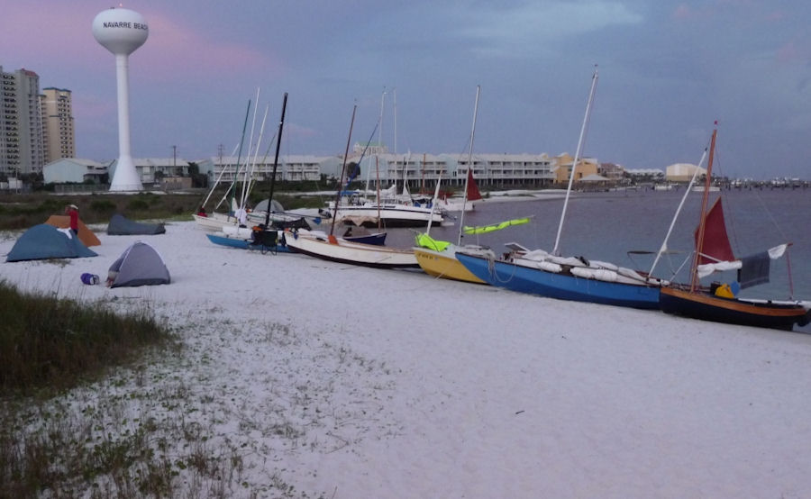
We camped on the beach that
first night, but
were able to get a shower. That came to
be the defining item each night. Could
we get cleaned up a bit after spending most of the day under the baking
sun? Thursday morning, after a short
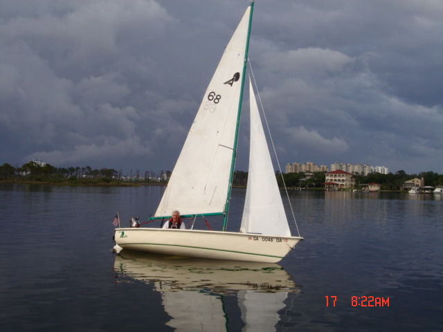
skippers
meeting, we were on the water at 9 AM. Right away, I noticed how
well the Wayfarer pointed
compared to most of
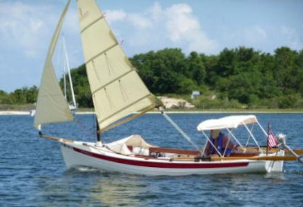
the other boats. An Apollo 16 (below)
was the exception.
 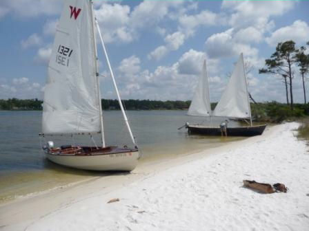 We sailed with a Sea Pearl 21 (above) for a while before stopping on a little
island spit for a
lunch break.
|
|
After the lunch stop, the first
obstacle loomed ahead. A bridge.
There was a small tidal current against us and the winds got really
fluky around the bridge. Some tacks
found us losing ground instead of gaining.
We finally tacked through with Robert calling out distances to the
bridge abutments to allow us to use all of the distance available prior
to the
tack. We found out later that almost everyone either rowed, motored or
received
a tow through that area. A short time later, we made a turn
and were
blessed with a close reach in about 12 knots of wind the rest of the
way to our
night stop.
...The harsh sun was more than I expected. I had a Garmin Oregon 400C with charting clipped to my life jacket. I tried to read it, but was unable to most of the time due to the glare. A couple of our pictures were taken by holding the camera up and shooting with the hope that it would capture something interesting. The early evening found us all craning our necks as Navy trainer jets went roaring by what seemed like just feet off the beach. We were directly off the end of their runway. Thankfully, they do not run all night. The beaches in this area are a bright white smooth sand. We ran the Wayfarer up on the beach, dropped the anchor in the sand above high tide (about 14 inches) and relaxed. I never had a problem with catching anything in the centerboard trunk. We did not sleep in the boat, but rather brought tents to allow a bit more stretching out. Many others did the same, although there were varied arrangements that complimented the varied boats. |
|
Some of the boats included: Laser
14, West Wight Potter 15, Norseboat 16, Windrider 17 Tri, Apollo 16,
Sea Pearl
21, Grumman canoe with a sail and outriggers, Compac Suncat 16,
MacGregor 25,
Cape Dory, and a host of home-made boats. It
sure was interesting to see how others were coping with
stowage of
food & liquids, sleeping arrangements, sail combinations, etc.
 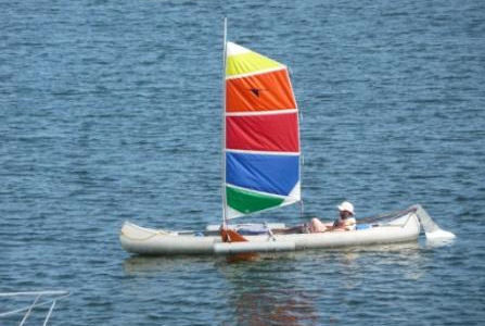 Norseboat, Grumman
Canoe
 Compac Suncat 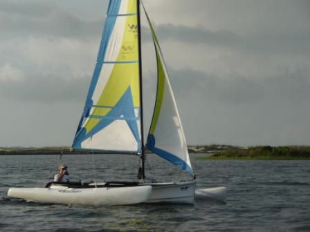 Windrider 17 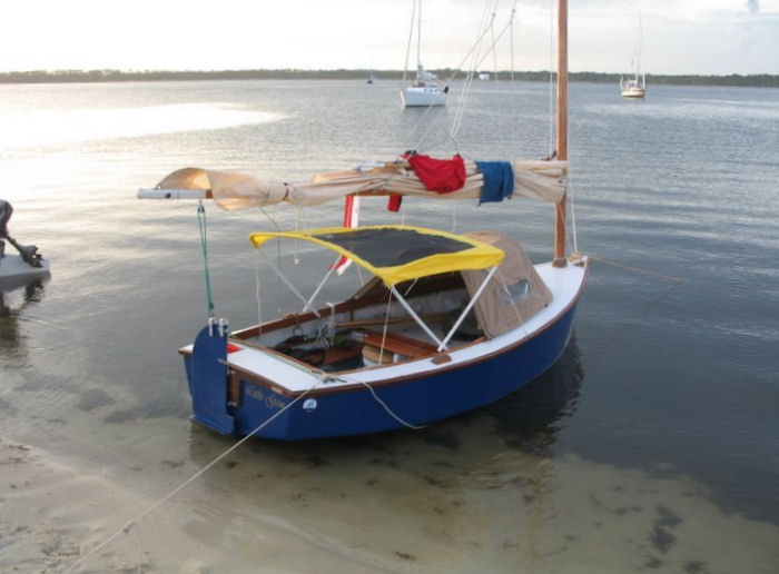 Home-built 12-footer 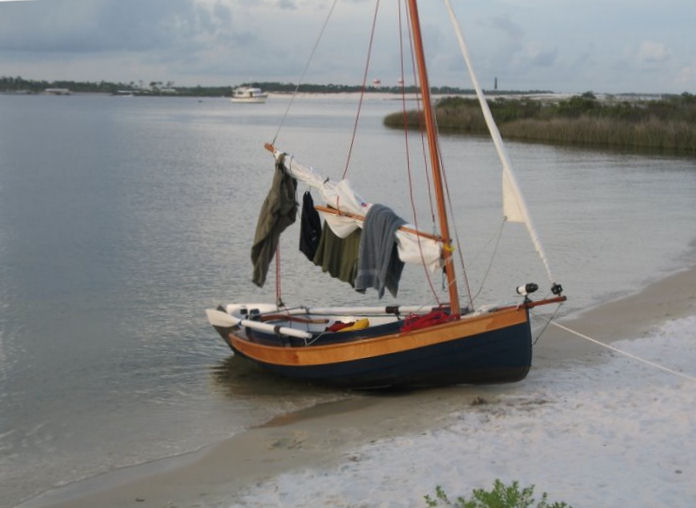 Home-built 10-footer 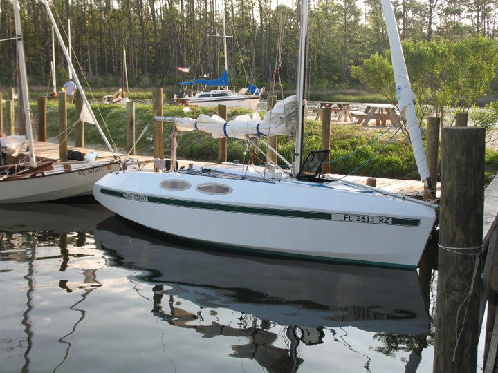 Home-built 19-footer 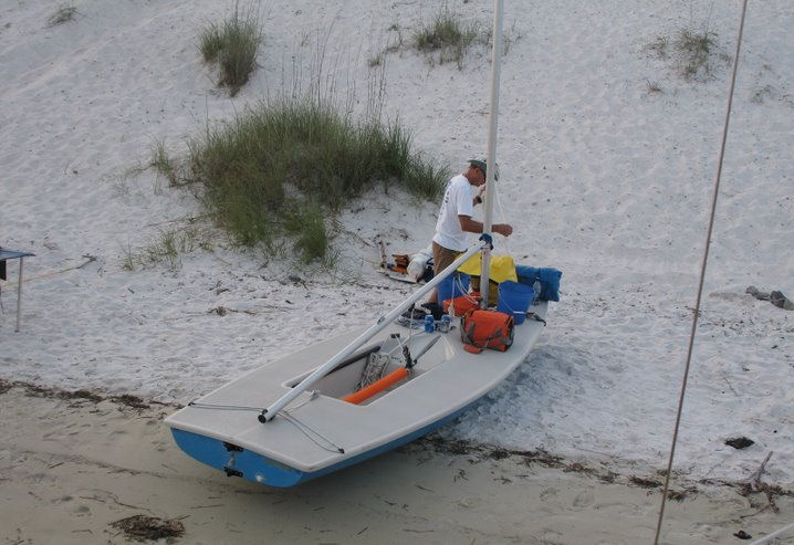 Laser 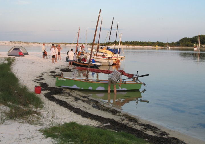 Home-built something in green 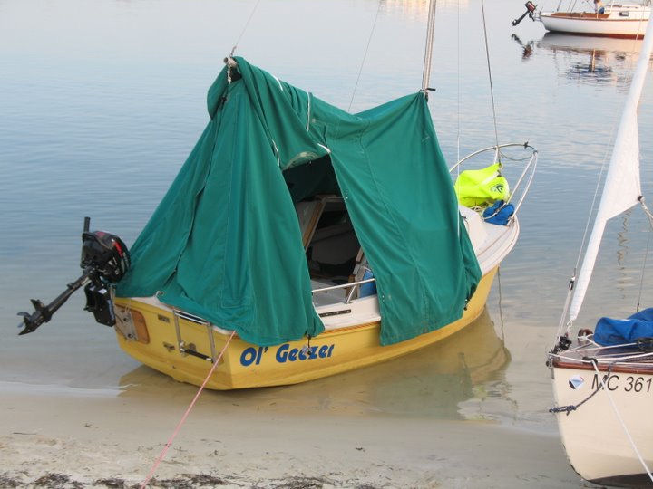 West Wight Potter 15 (I liked the name Ol' Geezer) |
|
Days
2 and 3
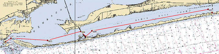 Day
2 & 3 = 25 miles x 2 Sand
Island
Florida to Quietwater Beach (005) for lunch and Navarre Beach (008) for
night
stop
The
next day (Friday), we had a brisk wind out of the East. Guess
which way we were headed! Although we didn’t leave with some of
the
earlier boats, we ended up sailing through most of the fleet and by
lunch time
we were so far out there, that we stopped with the Windrider, Apollo
and Laser
for a two-hour break while everyone caught up.
The burger shack at Quietwater Beach (see
pic below) was more than we could resist!
 As
the others trailed in, everyone was commenting on how well the Wayfarer
could
point into the contrary wind. The second
half of this 30+ mile day was upwind, but we were able to make it
to the
next stop on one long tack. Most of the other boats had to make a
zig-zag track to get there. This headwind
caused the group to agree to shorten the course and call it a day at
Navarre
Beach (below).
 Outside
showers, convenience store and restaurant were a welcome way to
reprovision at
the half-way point. Unfortunately, most
were too tired to enjoy the Reggae band that played into the wee hours
of this
Friday night. Once again we had a sandy
beach to run up on and set up our tents.
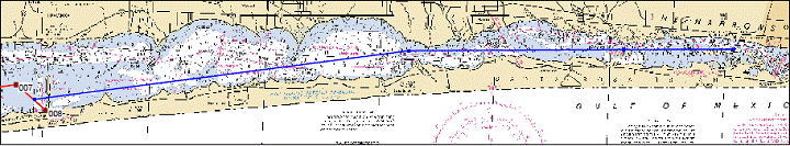 The part of our Day 2 & 3 plan that was not completed: 12 miles x 2 Navarre Beach to Spectre Island, Florida |
|
Saturday
brought more of the same: East winds, but not as much force. The
fronts that were passing mostly to the north
were getting closer. Our performance advantage
was less going downwind and we enjoyed sailing with
the fleet most of this day. But towards
the end of the day, we were once more ahead of most of the fleet and
stopped
with the Windrider at Fort Pickens, an abandoned Civil War fort which
was built
to guard the Pensacola inlet. Saturday
night found us beached on a barrier island at a
place designated appropriately Sailboat Cove.
We were only a short walk across the
island to the Gulf side. This had been a
long hot day of downwind sailing, very light at times, and the ocean’s
waves
washing over us were an extremely refreshing and welcome change.
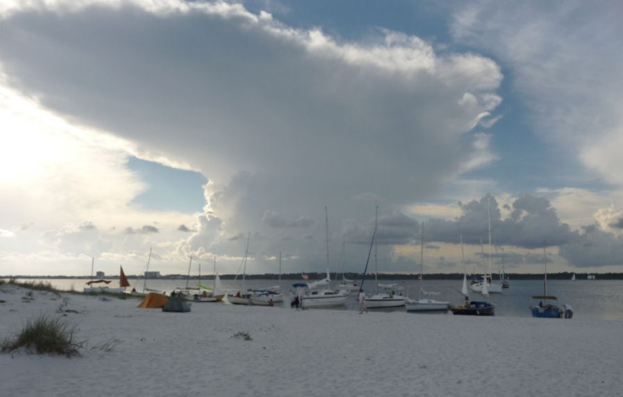 The big cloud picture was taken at our camp at Sailboat Cove. 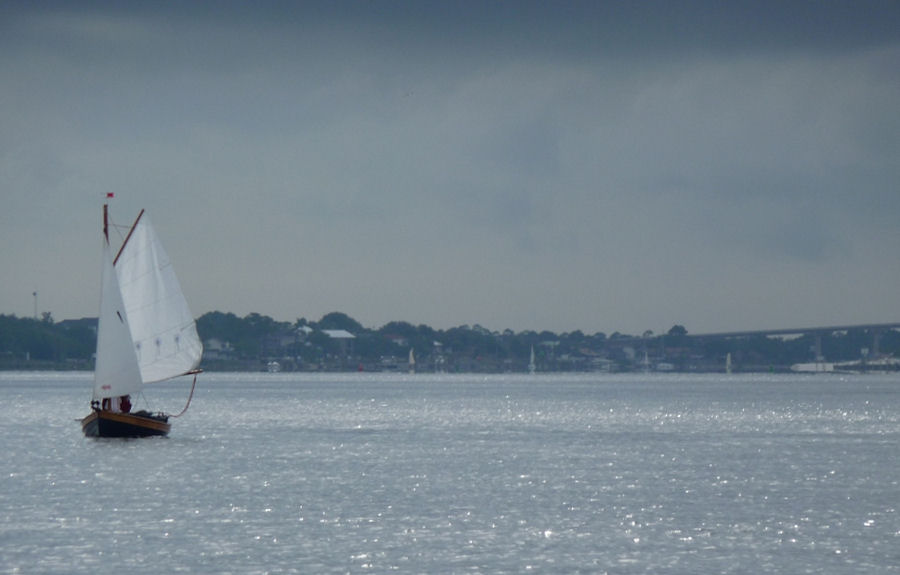 the last leg under the dark sky near Pirates Cove. |
|
Everyone was expecting rain
during the night, but the dew was all we
had to deal with while packing up the next morning. The
cloud formations were sure signs that we had to be prepared to get wet
on this
day. We spent another day of slow going in
even lighter breezes. At times, Robert
and I paddled and finally even resorted to the Honda sail for about a
mile or
two while watching the darkening skies get closer and closer. (It sure
looked
threatening!) Then the wind filled in a
bit and we shut her down and went back to sailing. The
rain never did reach us.
Robert and I packed up the boat in a hot, harsh sun. I asked the waitress at Pirates Cove if it was safe to have a Bushwacker (recipe below) and drive. She asked, “How many miles do you have to drive?” When I answered 930, she raised her eyebrows and promptly said “Sure!” I think that she just wanted to make sure that I would be leaving Alabama or at least her county. After a short wrap-up with the Bushwacker drink, we reluctantly got on the road. What a great sailing adventure this turned out to be! I think that I will have to plan on returning next year! Gary Hirsch (W1321) with Robert Mosher (crew) 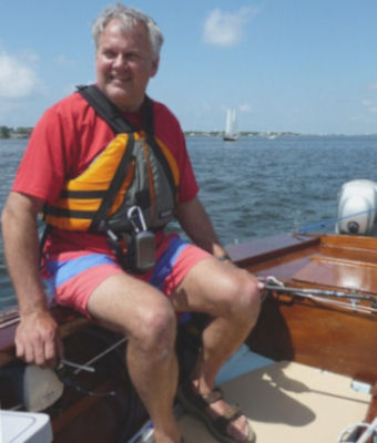 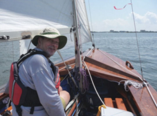 |