|
Friday/Saturday: St. Peters - D'Escousse For the last six years I have owned a Wayfarer dinghy. This 16-foot sloop has been a fine boat for family day sailing. With the use of a canvas boom tent and camping gear such as a sleeping bag, inflatable mattress, and one-burner Coleman stoves, she becomes a good cruiser for one or two people. I enjoy coastal cruising by myself and find the dinghy easy to trailer, launch, and sail single-handed. With this lingering recession and declining standard of living our Wayfarer, Naomi, provides a low cost means to continue to explore Nova Scotia the way the province shows herself best - from the sea. I took a week's vacation in July to go cruising. I hoped to sail around Isle Madame, an island off the southwest coast of Cape Breton Island. It borders the Atlantic, Chedabucto Bay, and the Strait of Canso. With a southern exposure to the Atlantic, weather conditions can be rough and foggy at times. If there was foul weather, I would limit my cruising to the more sheltered Lennox Passage, River Inhabitants, and the inner waterway along Isle Madame's western shore. Friday, July 16 Dismal weather was forecast as I left
Dartmouth for St. Peters, on Cape Breton Island. Strong to gale force northwest
winds were predicted for Cape Breton Island until Sunday. As I drove
across the Canso Causeway, rough seas breaking on the armoured stone barriers
deposited a greasy film of salt on my truck's windows. Arriving in
St. Peters, I couldn't decide whether to wait out the approaching weather
at the provincial park beside the canal or head out. I drove to the
ocean side of the locks. St. Peters Bay shoreline was sheltered and
winds were moderate. The lock keeper suggested a good anchorage in
nearby River Tillard so I decided to leave.
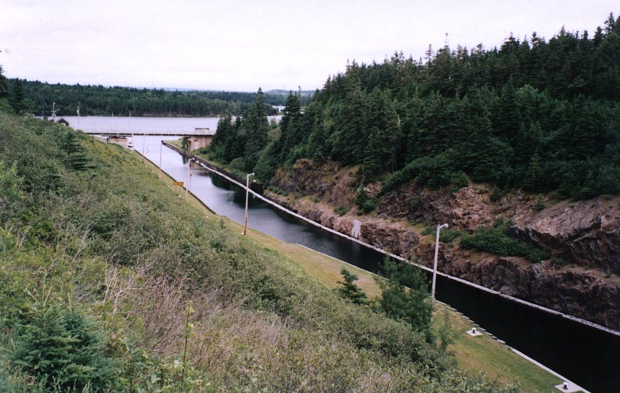
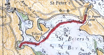 St. Peters is a village straddling a narrow isthmus between the Bras d' Or Lakes and the Atlantic Ocean. St. Peters Canal is a manmade waterway between the ocean and the Bras d' Or Lakes. Indians had a portage here before the French and British established a haul-over on which boats were dragged by oxen. A canal, completed in 1869, has since been renovated and is now a National Historic Site. This canal has double sea-locks since the water levels can be higher or lower at either end depending on the tide levels. |
 |
|
.. |
| There is a good boat ramp right by the
canal and here I launched Naomi. I left the mast down and
used the outboard motor to pass under the swing bridge and through the
canal before arriving at the lock gates. The lock keepers are willing
to open this bridge, even for a dinghy, but it blocks traffic and is extra
work for them. This narrow one-way bridge was once a railway bridge
in Ontario.
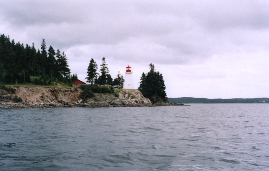
Naomi was the only vessel in the canal as I locked through. The lock keepers require the vessel's port of hail and destination. A few years ago my brother-in-law, Kevin, and I created some unnecessary concern when villagers thought we had been away too long on a cruise in Naomi. This time I informed the lock keepers that I would be gone for a week. Once clear of the canal, I shut off the motor and began rowing across the shallows. Even while keeping tight to the lee shore, I had a stiff row to River Tillard. |
 |
|
.. |
|
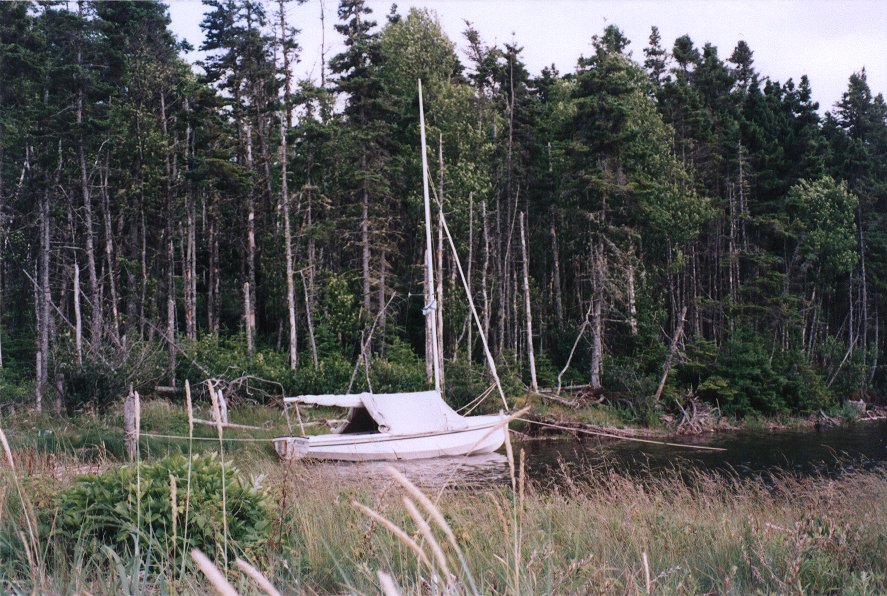
Here Naomi nestled against the mud and grass foreshore behind a gravel bar. A thick spruce forest hid this cove from a harsh wind overhead. As the tide ebbed, Naomi took the ground. During the evening I walked along the stony shore to Brick Point and near Sutherland Head. It was a pleasant change to be a beachcomber after driving to Cape Breton on the two-lane and congested Trans-Canada Highway. With high tide at 0700 the next morning, I wasn't worried about sleeping in and being stranded by an ebbing tide. |
 |
|
.. |
|
The forecast predicted intermittent showers
and winds increasing to strong northwesterlies by evening. Rather
than stay in River Tillard, I sailed for the village of D'Escousse on Isle
Madame. Sailing was easy until Naomi left the sheltered coastline
off Double Head. Lennox Passage is the channel separating Isle
Madame from mainland Cape Breton. Winds tend to bend and funnel through
the passage.
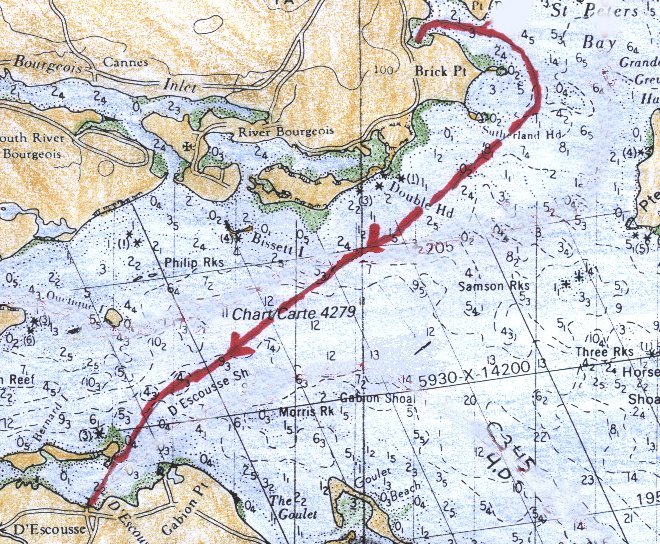 Rain squalls lumbered down Lennox Passage causing poor visibility and bringing gusty winds. Short seas slammed against Naomi's hull and spray showered the cockpit. I couldn't see any buoys but a conspicuous red barn in D'Escousse and the white church and steeple of River Bourgeois made good landmarks. Behind Bernard Island, I brought Naomi ashore while I furled the sails and tided the boat. Then I rowed across to the D'Escousse wharf . .. 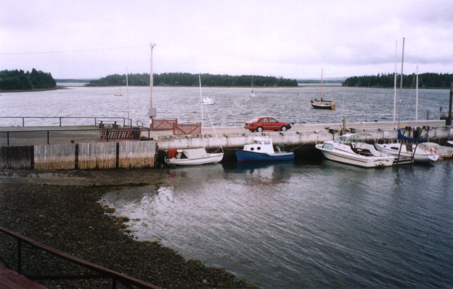 Because the wharf was crowded, I tied Naomi at the wharf's head (photo above), although I realized she would dry out at low tide. However, some locals suggested (demanded) Naomi be tied alongside one of their boats and then gave me a hand shifting her to this better location. There is a small and friendly boat club by the wharf. Members of the Lennox Passage Yacht Club made their clubhouse and facilities open to me. I thought my crossing of Lennox Passage had gone unobserved, but several people came along to mention they had seen Naomi's crossing and to comment on the weather. D'Escousse is a small village stretching along the coastal road. At least two versions exist on the origin of the name of the village. One is that the name means "a resting place" in French and the other version is that the village was named after an officer of one of the French regiments stationed at Louisbourg. The village has two small grocery stores, a credit union, church, and community hall. After walking through D'Escousse in the brisk wind and drizzle, I considered what to do next. I decided to cruise in style by staying at the local bed and breakfast Saturday and Sunday night rather than remain aboard at the wharf in this inclement weather. The bed and breakfast is in a 19th century home about 150 yards from the wharf. The owners, Al and Sara McDonald, live in a home beside it. By 2130 I was ready to retire for the night. |