| A
Norwegian Cruising Experience Ralph Roberts, Wilhelm Munthe-Kaas and Blunderbus (W1309) explore some islands off the coast of Norway just south of the Arctic Circle in mid-July 2002 Part 2 of a log by Ralph Roberts .. |
|
Day 5: Hysvær to
Skjærvær
I
slept well, and only woke when I heard what sounded like
a heavy downpour outside. It was Øystestein, up on the roof
again with his high
pressure hose. How long he had been up I had no idea, but I could
certainly
have slept for another hour or more.
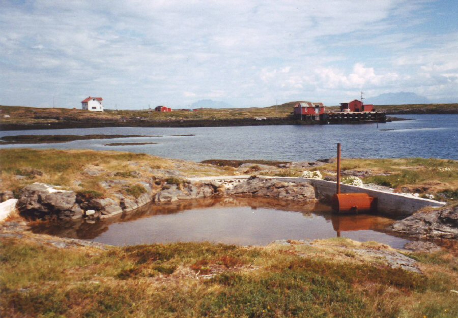 The water level of
Øystestein’s
heated open-air swimming pool was about 600 mm lower than it should
have been.
I
wandered over to the outdoor bathing pool that Øystestein had
created from a
stream going through a natural depression in the ground. He had dug the
mud out
of the bottom of the depression, and then built a wall to dam the flow
of
water. An old boiler he had found washed up on a nearby shoreline had
been
built into the wall so that access could be gained inside to light a
fire.
Unfortunately there had been little rain during the previous months,
and the
water level was so low that the boiler was above the water line, but
Øystestein
confirmed that when the pool was full, the boiler warmed the water very
effectively. It might not have been most people’s concept of a heated
outdoor
bathing pool – more of a ‘scrap heap challenge’ version - but one
certainly had
to admire the enterprise and ingenuity of the project. There being no mains
water on
the island, this pool made for a useful opportunity to bathe in fresh
water.
... We packed the boat and set off from the island before midday. Our next destination was Skjærvær (pronounced Shardvard!), the last group of islands beyond the coast – the next land to the west being Iceland. We first visited a well-known bird colony on the most remote of these islands, which, according to our guidebook of the area, should not be approached too close for fear of disturbing the nesting birds. There seemed little risk of this however, since the noise and particularly the stench was enough to keep anyone at least 200m away! 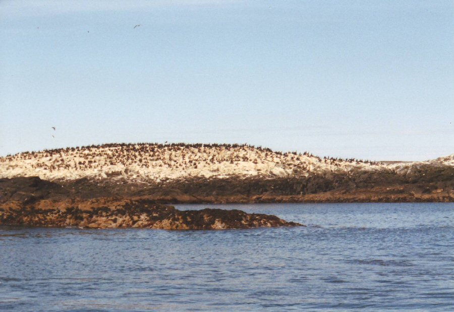 This
is the only island in the area where
these cormorant type sea birds nest. It is completely exposed to the
sea, making it vulnerable to gales and big seas which can break over
the narrow outcrop of rock, washing away all the nests.
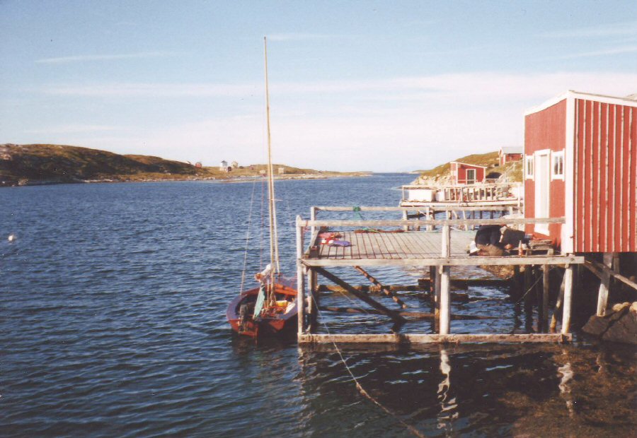
Stopping for lunch after retreating to a fresh air distance from the bird colony, we tried some fishing, which involved pulling a silver coloured weight up and down, the movement attracting the fish apparently. Obviously, I didn’t have the right technique, as I didn’t get a single bite! We then sailed on to the largest island of the group, where there had once been a thriving fishing community, but the island was now deserted. Rocks had been quarried immediately adjacent to two extremely well built harbour walls, which enclosed a large area of water, so the fishing must have been very prosperous at one time. Rounding the harbour wall, we headed for a substantially built wooden jetty. 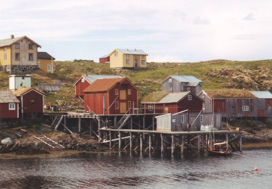 There were many more solidly built houses to the left of the picture. It seemed amazing that the place was entirely deserted. Wilhelm tied the boat off the main landing stage, and we walked along the nearby wooden building to the only door that was unlocked. This was intentionally left open for visitors, and we quickly made ourselves at home, signing the visitors' book where I could see that I was far from being the first 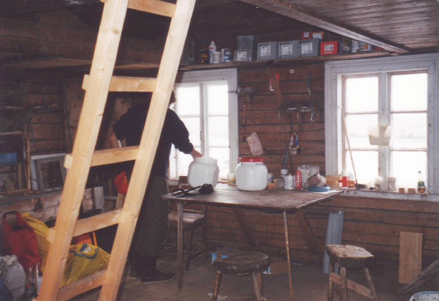 Wilhelm
prepares our meal in the visitors' cabin. Whilst it looks as though the
ladder provides access to a
bunk area above, in practice it was barely possible to squeeze into the
space
available, and we ended up sleeping on the floor.
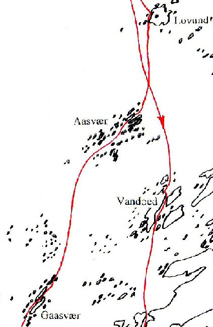
It seemed very strange that there was no look of dilapidation about the place. In fact everything appeared to be very substantially built, and yet there was nobody to be seen on the island. Some of the houses appeared to be holiday homes, with flagpoles outside. It is always customary in After enjoying a good evening meal, we cleared the floor to spread out the seven detailed charts of the area so that we could determine what might be the best possible route for the rest of our trip. Wilhelm’s aim was to reach the outer island group of Træna, before returning to Brønnøysund via Alsten, one of the larger inner coastal islands which had a mountain range called ‘the seven sisters’ he particularly wanted to climb. The floor then provided us with a hard, but useful place on which to sleep. |
|
Day 6:
Skjærvær to Gaasvær
We
were
woken around 0030 by the sound of a fishing boat entering the harbour.
It
proved to be the owner of the island, whom we met the next morning.
Wilhelm was
keen to learn about the island’s history, and whilst they chatted, I
packed the
boat. It proved to be one of our more early starts, as we were off
before 1100.
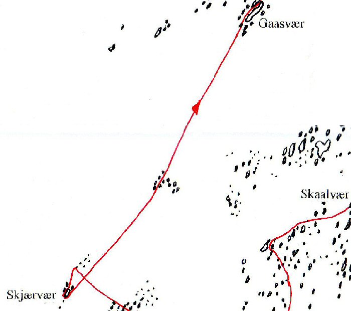
We planned to sail due north to the much larger
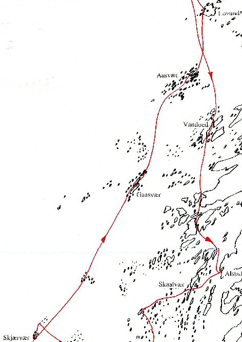 We
started out in beautiful sunshine with a good following wind. It was
the first
time we had experienced such ideal sailing conditions, and we expected
to reach
Lovund (above) without
difficulty. By the early afternoon however, the wind had backed
to a more northerly direction, and later dropped to only a light
breeze, so the
motor was used once more to make our way to a nearer group of islands
called
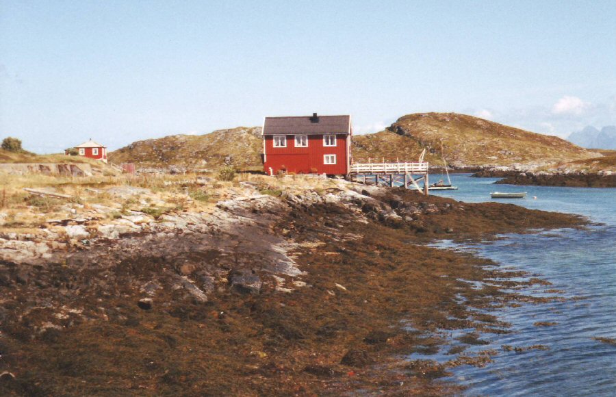
Gaasvær (below).
  It was the only such picture we would get on the whole of the cruise. Gaasvær
proved to have only a slightly greater population than
Skjærvær, with at least two
of the houses occupied. It, too, had obviously once been a more active
community, with both a church (still in use, though locked) and a
school (now
closed down). Any thoughts of making further progress toward Lovund
were
dispelled by the lack of wind, and by a local fisherman, who gave us
two fresh
cod to cook for our evening meal.
 We
set
up our tents behind the fishing sheds attached to the jetty, and walked
around
the island, inspecting the remains of what
clearly
was once a considerable and thriving
fishing industry, with rail tracks between two production warehouses.
We slept
well that night after eating more than our fill of the tastiest locally
caught
fresh cod I have experienced.
... |
|
Day 7: Gaasvær to
Aasvær to Lovund
It
was
very convenient that - unlike sailing in the UK - the time of high
water or the
direction of the tidal flow was of little concern, and our only
consideration
when setting off was the weather. With a strong following wind the next
day, we
set sail under reefed main, and Blunderbus
surged along in the short swell,
creaking rhythmically in time honoured wooden fashion, and seemingly most
happy to be continuing her fine cruising traditions.
 The
last group of islands due north
before Lovund was Aasvær. It was a maze of islands
similar
to many of the other
groups, and by exploring the various channels between the islands, we
came upon
a small but superbly sheltered harbour, with a few fishing boats and
other
small craft that were either on moorings or tied to jetties. Spotting a
floating pontoon
ahead, we felt this would be an ideal time to stop for a lunch break,
and to look around the island.
 Blunderbus
moored to a pontoon at the narrow and shallower end of the
small and well used natural harbour on Aasvær.
 Aasvær.
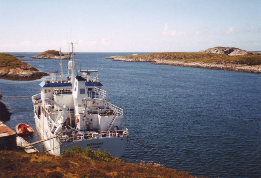
Hidden from view on the other side of
the island was yet another, deeper channel which looks
out to the southwest and provides the deep water exit to
the open sea. Here, a hydrographic survey ship
was moored to a once busy commercial jetty.
Whilst Wilhelm chatted to a local in order to discover more about the place, I set off to the top of a small hill to gain a better view of the surroundings. Looking down from a height, one could get a broader perspective of the many islands and channels. 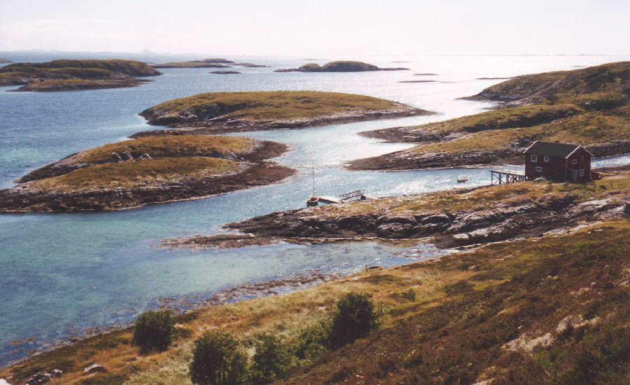 Looking
out to the south-east from a
hilltop on Aasvær. The many channels can be seen much more
clearly from above
than when on the water, where foreground and background merge to
conceal many
of the entrances. Blunderbus
can (just) be seen near the centre of the picture.
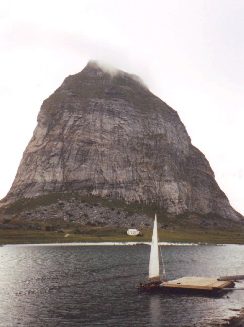
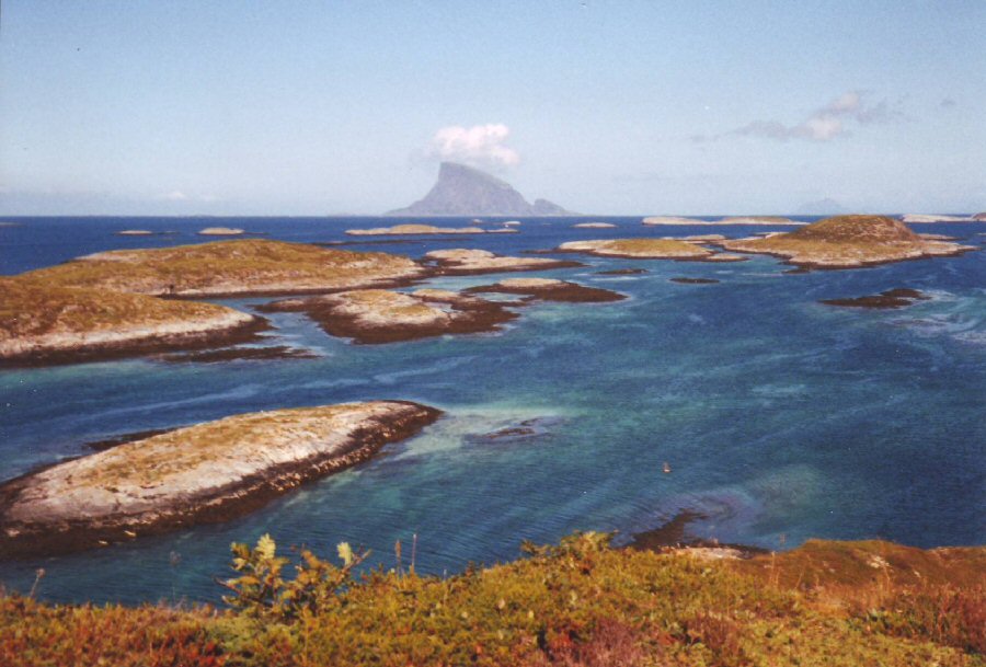 Looking north toward Lovund, with its clear Gibraltar Rock shape. The cloud formations which the peak caused were even more pronounced as we sailed past on our return, when the island produced a stream of clouds like a steam engine. Whilst the wind had started out very
fresh in the morning, it dropped significantly whilst we were on
Aasvær, and we
took the reef out of the main before setting off. Wilhelm spent next
part of
the trip trying to get me to pronounce ‘Lovund’, which sometimes seemed
have an
‘a’ added on the end, and I eventually managed to ‘sing’ this with the
right
inflection to (nearly) pronounce it correctly!
The
wind continued to drop during
the afternoon and we had to use the motor as we approached the lee of
the wedge-shaped 620m
mountain.
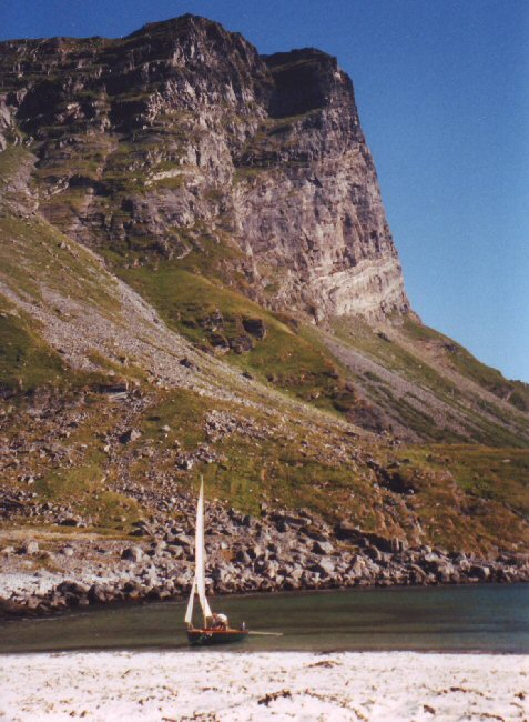
We noticed an enticing sandy beach in a bay as we
cruised up the west side of the island. Initially we thought it would
be worth
pulling up on the beach if only to take a photo of the Wayfarer against
the
backdrop of the mountain. However, we soon appreciated that it would
make an
ideal camping spot for the night, with a large flat grassy area kept
short by
wild sheep.
Also camping near the shore were a
couple on a canoe tour of the area, and another couple who were sailing
along
the coast in a traditional Norwegian sailing boat, which they had left
at a
harbour on the mainland. They had used the ferry to get over to the
island to
spend a few days exploring it on foot with their dog.
 Wilhelm had to walk round the other side of the mountain for his ascent. The Puffin colony is on the face of the mountain just to the left of the photo. 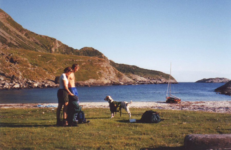 It
wasn’t until the photos were developed
that I found that the two shots above
could be professionally put together to make a more panoramic view. After setting up our tents, we
walked round the northern headland and into the main town on the
island,
stopping at a hotel for Wilhelm to enquire the route to climb to the
top of the
mountain. This seemed quite a popular pastime, since the girl at the
bar
quickly produced a leaflet with that and other trails marked on it. I
decided
on something rather less energetic, and ordered a glass of beer. This
cost me
50 Nkr – about £4. Fortunately I had been aware that drinks are
expensive in
I wandered around the small town
before heading back to our base, and was in time to watch the island’s
famous
Puffin colony return from the day’s feeding out at sea. Hundreds leave
the
mountain each morning and their return was a truly amazing sight – as
they soared into
their nesting site in small black, cloudlike formations.
Wilhelm returned around
... |
|
Day 8: Lovund to
Træna
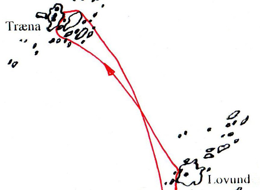 Next
morning the wind was blowing force 5 from the north. No problem for our
proposed trip out west to Træna, but the canoeists we had
befriended, Ole and
Torunn, were apprehensive about setting out. We mentioned that we would
keep an
eye on them if they decided to make the trip, something we later
thought
perhaps was not such a good idea, since it certainly influenced their
decision
to go. Acting as an escort slowed us down considerably for the first
half of
the trip, but eventually they allowed us to give them a tow, which
enabled us
to reach Træna in reasonable time.
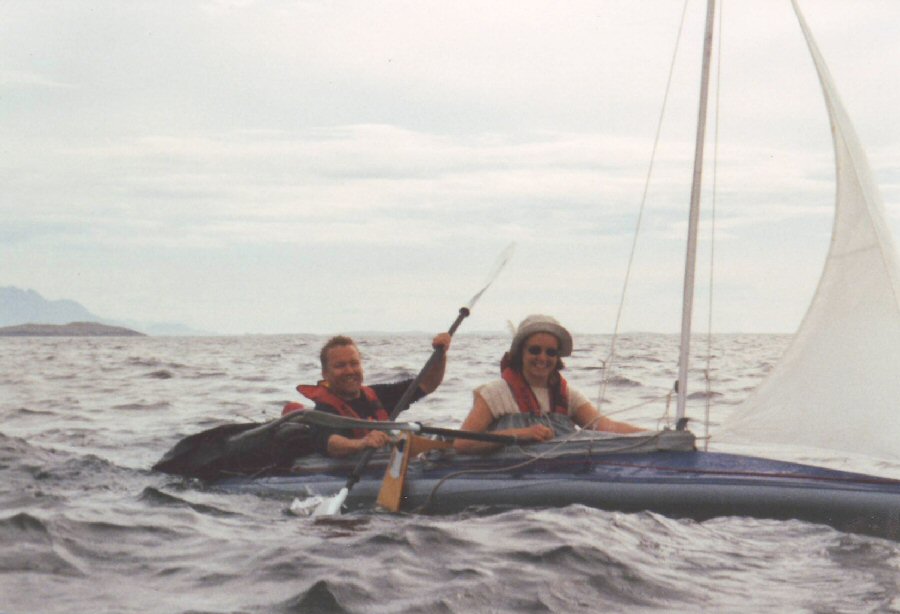 Ole and Torunn in their canvas canoe on
their way to Træna. It was Torunn’s first canoe trip and she
always seemed to
have a happy smile on her face. I’m not too sure that either of them
were fully
aware of the potential dangers of canoeing in such cold , exposed seas.
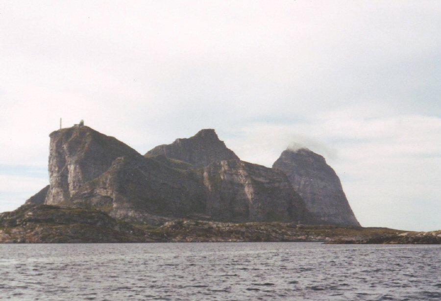 The
three peaks of Træna. The nearest one being rather spoilt by the
radar station built into the top. The natural
 Blunderbus at her pontoon whilst
Wilhelm makes enquiries about camping.
Wilhelm’s chart showed a sheltered
bay on the westernmost of the two main islands, with its three
prominent
mountain peaks. We headed for this spot after dropping off at the first
island,
our intrepid canoeists who desperately needed a comfort stop! We tied
up to a
pontoon so that Wilhelm could enquire where we might camp for the
night, and
before Wilhelm’s return, Ole and Torunn paddled in round the harbour
wall to
join us again.
A sandy beach to the north of the
bay, next to the local cemetery was recommended as the ideal place to
set up
our tents. Landing was no problem, but finding a flattish area to pitch
our
tents proved rather more difficult. Ole and Torunn managed to resolve
this
rather better than Wilhelm and I, who both woke up several times during
the
following night to find that we had rolled off our sleeping mats.
We spent the evening exploring the
more exposed west side of the island. I took the easier route back
between the
single taller mountain, and the adjacent range with its twin peaks,
whilst
Wilhelm continued along the coast and then over southernmost peak, the
one with
the NATO radar station. After making plans to explore more of the
island the
next day, we retreated to our tents for a less than comfortable night.
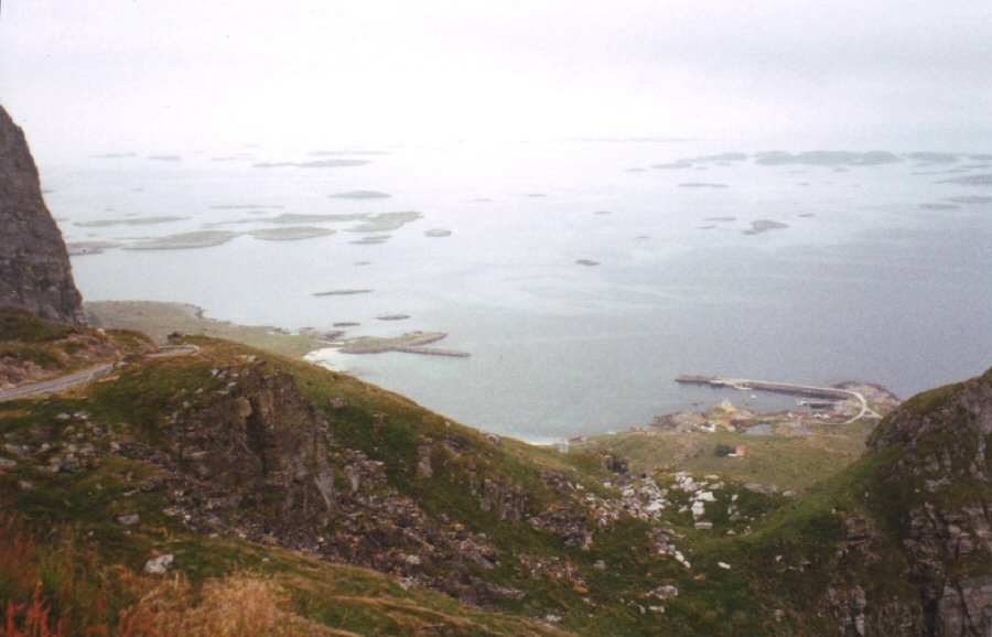 The
view from near the Radar Station at
the top of the first mountain.
...We were camped by the sandy beach to the far left of the sheltered bay in the photo. |
| Part 3 (conclusion) return to this log's index |