| Round
Georgian Bay by Joy Phillips (W866) * July 14-31, 1973 Part 2: July 17-19 ... |
| July 17th Tuesday.
0630: Up,
breakfast and packing up. Lovely day at first,
but by 0740 fog had rolled in. Don decided it
would be silly, to deliberately
test our navigation by
going out, so we waited till it had gone, an hour and
a half later.
0905: Clearing 0945: Off again. 0954: Rounding Northeast Point. 1006: Passed 64. On range between buoys. Compass reads 310. Range is 304T, 312M. Just to the north is the mouth of the French River. Down this river came Étienne Brûlé in 1613, sent by Champlain to explore this part of Ontario for the French. 1012: Passed 68 (outside). About 5/16 mile in 6 minutes. Speed 3kts. 1018: Passed
76. This is the last mark in the east-west
channel that runs north of the Bustards, which is
romantically called the "North-East Passage."
Now we curve gently south-west, past the last shreds
of the Bustard Islands and 1048 the Bustard
Lights. There are three all together on one
island and the chart shows them all green. From
the chart, the east light forms a range with the
center light to guide the approach from the
northeast; and the west light forms another
range with the center light to guide the approach from
the west-south-west. Now we begin a long
(fifteen mile) outside passage, which will take us in
a generally north-westerly direction, to the point
where we can turn north-east to enter Beaverstone Bay.
1054: Shining Hour, a big black private fishing boat out of New York, passed us. 1056: Don says
to take a course 282M from the Bustards to Grondine
Rock and then meet again. Take care over rocks,
as this is considerably further in than the marked
channel. Wind Force 1-2. Sun.
Conditions perfect! ETA Grondine 1400 or a
little later.
1110: African Queer ( or a very similar boat) passed us again, headed S of W. 1118: Bad River
Channel range bears 027M, 019T. Chart gives this
range as 018T. Good! Bustards 110M, 102T,
which puts us about a mile closer in than the channel,
as planned. Passed close to the black/white
striped buoy on range for Bad River Channel.
1150: Crossing
range for Maitland Bank. Our compass bearing was
353; true is 334 º 30' magnetic 342º
30'. N.B. Bearing of Bustards at time of
fix was 118M instead of 106M. Was pocket knife
affecting compass? In 12 minutes' time, sailed
just under 1/2 mile. Speed 2.3kts. Three
huge powerboats flying U.S. flag passed, heading E.
1235: Two big powerboats visible on port beam. This is the sound of engines we've been hearing for some time. They appear to be heading inland. 1315 Tom and Pete spotted Grondine Rock. Winds light. Small motorboat, heavily laden, passed from starboard side, apparently heading for Grondine Rock. 1334 Two big powerboats passed on port side, heading for Grondine Rock. Must be a good fishing spot! 1335 Rowing. 1335 Light wind got up. 1412 Grondine Rock abeam to port. 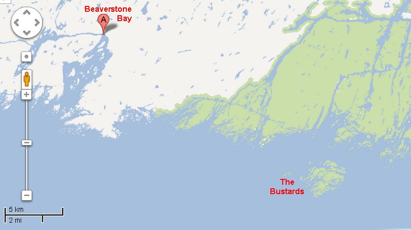 Long, slow
reach. An hour later a mark was sighted and it
turned out to be the wrong mark. Don spotted
the right one, much further out, and hardened
up. Rocky bottom visible. We were over
The Chickens! Reef awash close to starboard.
Cut just inside red mark 78 and followed channel up
into Beaverstone Bay. Don and Connie had an
older chart and did not notice the newer range to
starboard. They had to be signaled on the
foghorn to get them back. They were headed for
"Numerous rocks and shoals" - which looked quite
murderous when we saw them from the lee side a few
minutes later.
1547: Mark 86 in
Beaverstone Bay abeam. The mouth of Beaverstone
Bay is almost closed off by islands varying in size
from half a mile square to mere chunks of rock.
We are now well inside this barrier and the Bay has
opened out. At its widest point it is nearly two
miles wide with islands scattered more or less in a
line up the middle.
1553:
Beaverstone Bay Lodge abeam to starboard.
Presumably a hunting and fishing lodge - perhaps the
source of some of the fishing boats we saw outside the
Bay?
1612: Beaverstone Bay is gorgeous! The land slopes quickly from about 100ft. to water, and is rock or forested. All the water up here is so clean and blue. We are just passing the black daymark two islands north of Lang Island, with a red buoy and two black daymarks close together, in sight ahead. 1620: Red mark 88 abeam. At this point the bay closes in to form the beginning of Collins Inlet. 1622: Just
coming up to the black daymark on Pisa Rock - we are
about at the 46-mile mark on the Small Craft
Chart. (The mile markers on the chart are
statute miles. All other miles referred to in
this log are nautical miles.)
1638: Between 55 and 96, which is the 47-mile mark. 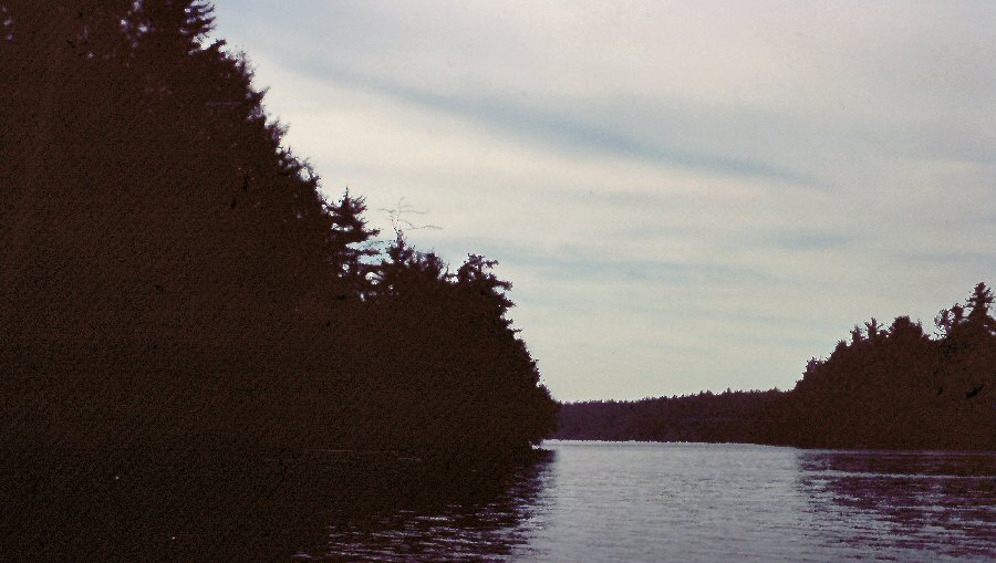 1640: Entering Collins Inlet - gorgeous! This is a narrow channel, running east-west - i.e. almost at right angles to the marked channel up Beaverstone Bay. This part of it is 100-200 yards wide, and about two miles long; then it opens out into a biggish lake (Mill Lake) with three bays at the north end. The first of these is Sawdust Bay, but they must have got tired of thinking up names after that, for the others are Second Bay and Third Bay. Winds now light and flukey; Tom and Pete rowing. 1701: Some breeze - didn't last long. 1745: Yellow water-lilies in flower. Winds very light and flukey. Tack-tack-tack into the sunset. 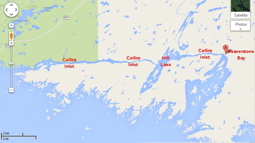 Finally we came
out into Mill Lake and found a safe spot just inside a
little bay on the far (western) side. Supper
tonight was rounded off with some of Pete's superb
home-made wine. This had been a feature of the
cruise so far, and we had come to look forward to the
moment when Pete extracted a white ex-bleach bottle
from the locker. Tonight's - the last of Pete's
supply, unfortunately - was loganberry wine, made from
the fruit of a loganberry bush just inside Pete's
front gate. An excellent vintage!
 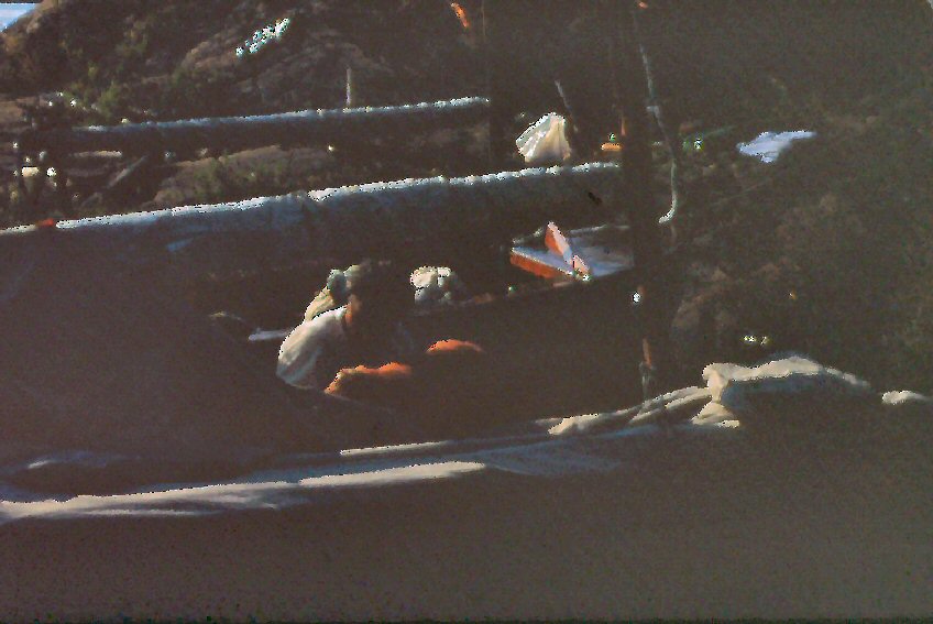 Our bay seemed
quiet enough when we made camp. One house was
marked on the chart on a nearby island, but that did
not account for all the traffic. During the
evening, early night, and again from about 0500 next
day, that bay was like Union Station. Fisherman
came, cast for five minutes, and left. For that
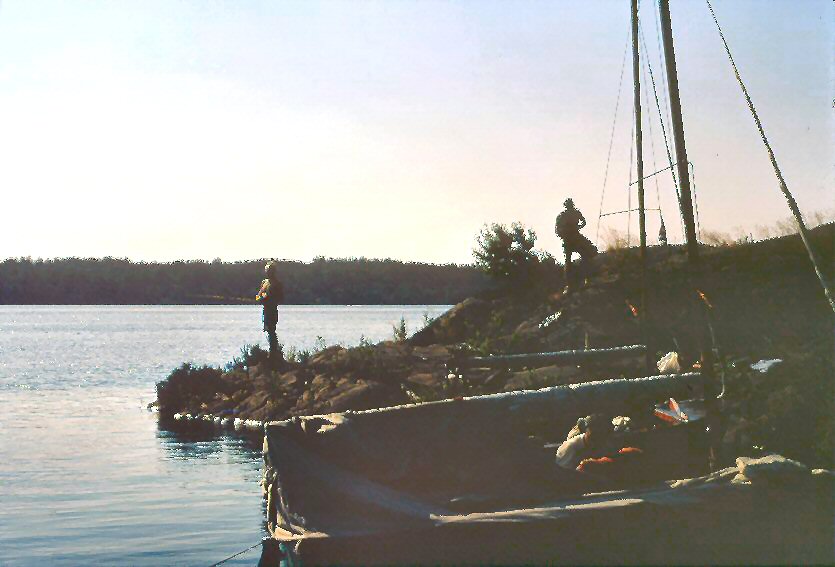
matter, Connie and Pete tried to catch breakfast, but
had to be satisfied with bacon and eggs again.
Perhaps our swimming had something to do with the
fishes' wariness - at any rate, Pete remarked next day
that once we were all turned in, he heard fish jumping
and laughing at us all night.
July 18th, Wednesday 0945 Off again. Lovely sunny morning, water sparkling, wind SSW, Force 4. Main only. 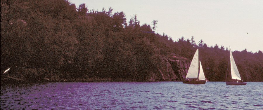 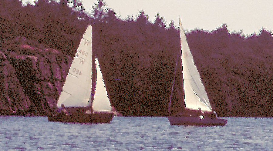 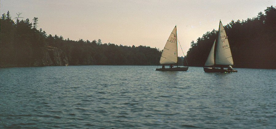 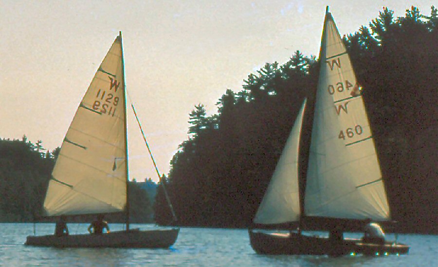 0955 Entered
Collins Inlet again, for the second part, west of Mill
Lake. Winds flukey in the narrow inlet with the
true wind almost at right angles, so put up jib too.
1010 Passed Wharton Lodge to starboard. Source of some of the night's fishing boats? This part of Collins Inlet is eight miles long, and even narrower than the first section. At its narrowest, it is only a hundred feet wide. Winds funnel along it and today are west or south, so we are beating against a flukey breeze. 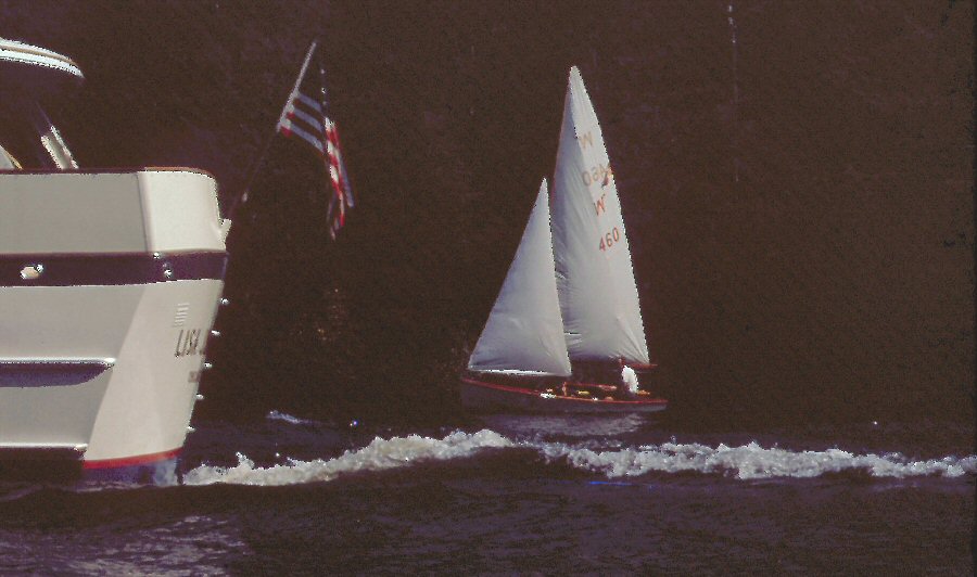 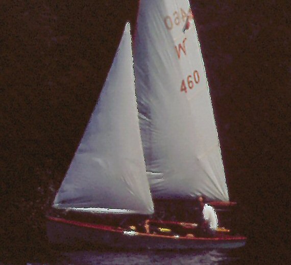 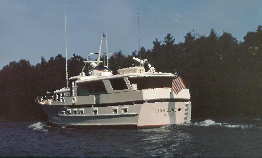 1050
At
one of the narrowest parts, Tom looked back and called
- "Look what's coming now!" and following us
steadily was the biggest white power boat any of us
had ever seen. In that narrow channel, she
looked to me about as big as the ferry boats that
carry hundreds of people across the Mersey at
Liverpool. On this occasion sail gave way to
power, and while we cowered by the rock walls, Lisa
June IV out of Chicago, pushed through the
channel like a juggernaut.
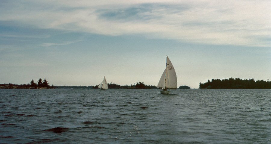
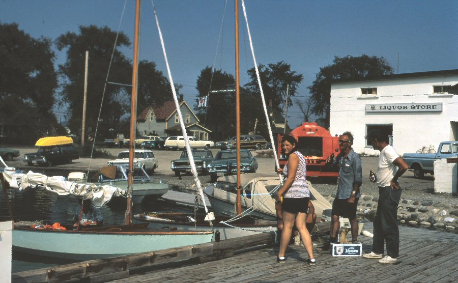
At this point the wind picked up a little, and we were beating with 10-20 second tacks. 1110 Biggish sailboat spotted coming the other way. 1118 She's under power! What a waste. 1124 A Hughes 24 coming the other way - also under power. What are they about? They could have a lovely run this morning. 1141 Three small powerboats passed us going West. It is quite hard to get the names and pay attention to the water ahead (though it looks deep right up to the land most of the time) and tack so often. The last one was the Amy Something II. 1205 Interesting-looking power-boat, blue, no name, passed going East. Perhaps a workboat? Superstructure looked homemade. 1222 Nasty big blue powerboat, the Good Day Susie, passed West-bound, and behaved badly, going at high speed and making a lot of wake. She was flying the U.S Flag at the stern, and the Canadian flag over the Belgian flag at the mast-head. 1255 Anchored in a cove, for Alan to swim and the other two boats to catch up with us. Not a good place - too little shelter and too many weeds and logs. Two more great powerboats passed us, though we didn't get the names. We have a lot of company on the water today. 1511 Passed 59. 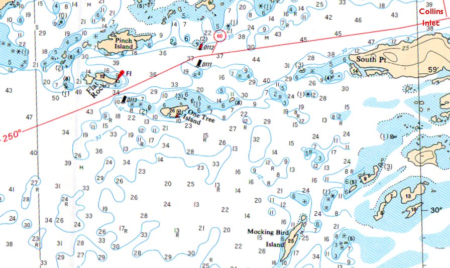 1515 Passed between mark 61 and the flashing light on Flat Rock. Roughly 1/3 mile between this pair and the last, so 12 minutes per mile and speed is five knots. Course 250 marked on official channel on chart - 258M. Our heading is 252M to allow for leeway. Wind Force 3, waves 1-2ft. About three miles to Red Rock Point Light at entrance to Killarney Channel, and another mile up the channel to Killarney. ETA 1603 1530 Whee-ee! This is a beautiful close reach, and we seem to be whizzing along. This is the life! 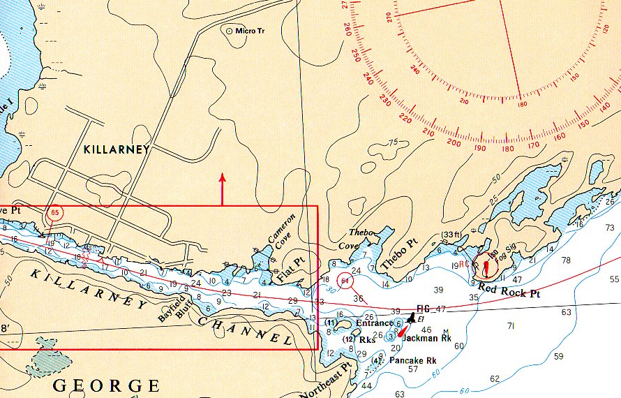 1549 Red Rock Point. Light abeam. 1620 At Government Dock in Killarney. The channel is sheltered, and it took rather longer to do the last mile than we'd bargained for. Government Liquor Store - boldly so labeled - is the first building you notice. This is a bad place to stay, and we shall probably provision and move on. There is just a dock, and no facilities at the waterfront. It will be very public cooking breakfast on the dock in the morning; and tonight I dislike blowing up the air mattresses to an accompaniment of jeers from badly-behaved children. (The Hanson Air Mattress Adapter has not yet been invented.) 1625 Tom and Pete arrived. 1633 Pete appeared with two 12-packs of beer and a bottle of rosé for dinner.   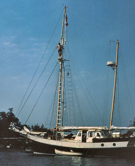 There are some interesting boats here. The Snow Goose, a massive great motorboat out of Montreal, shares our dock; further up is a beautiful big boat with clipper lines, the Gem-Jig. She is just gorgeous, with lots of real wood - even a wooden rail instead of life-lines. Don met a friend sailing a chartered 28ft. boat, and his tool-kit included a hacksaw, which ours did not. Alan borrowed it and sawed 3" off each leg of our boom crutch, thus making our tent fit again. It had shrunk after being folded up wet on the foggy morning at Tanvat Island, and we were lucky to have had fine weather since then. Now, it may rain again, and we shall be snug - albeit a little too snug, since our "house" is smaller. We ate supper at the Rock House Inn, after a discussion about what 'Rock' might mean in that context. Fortunately it turned out to be the kind of rock we'd been sailing among, and not the kind of music they played. Some of us had been looking forward to a juicy steak, but that had to wait, as we were offered sausage, pork chops or turkey pie. Alan called Jim at home to warn him to stand by later in the week for a message to come up and take over the boat for the rest of the cruise; we are behind schedule and have had no layovers yet, prompting someone to remark "Join Davis Tours and See Fifteen Countries in Four Days"! We did, however decide to stay the night at Killarney as no one felt like moving on once we had established ourselves at the dock. (Alan also asked Jim to get a new gooseneck from Avon Sail Boats.) Finally turned
in, feeling rather as though we were on stage.
July 19th Thursday. 0645 Up, and ate a simple breakfast (Joyflakes, bread and marmalade and milk - no cooking required) as a good proportion of the juvenile population of Killarney was already goggling at us. Aired sleeping bags on the dock nevertheless, and washed the dirty clothes which were threatening to mildew in the dirty-clothes bag.  0945 Left Government Dock. Overcast and threatening rain. No wind. Rowed all the way down the channel. 1030 Departed green buoy at channel mouth. Rowed 10 minutes and then 'sailed', but very little wind and a one foot swell. Alan and Don compared compasses. They agree pretty well. 1053 Still almost no wind. Timing log chip indicates speed 1/2kts.. ETA at flashing red bell buoy 0430 tomorrow! Don remarks it can't get any worse so it has to get better. Alan replies it could get worse - the wind could drop! 1103 Three big powerboats going into Killarney, all with U.S. Flags. Rain; haze; visibility about 2 miles. 1115 Rain stopped. Sun trying to come out. Wind E - beam reach, port tack. 1120 Wind picked up. Speed about 3kts. Visibility improving. 1125 Rain again. 1129 Rain stopped again. Issued snacks, and filled water-bottle to about 1 ½ gallons by dangling it over the side with cap off and air-vent open. I can't easily lift more than this back into the boat. 1150 Speed 3-4kts. ETA bell buoy now 1400 (today). Close-hauled on port tack. 1200 Wind dropping. Sun shining. Wind soon picked
up again.
1240 Wind heading us. We are now heading so as not to fetch, or only just. 190-200M (was 215 for a while.) 1245 Force 3. 1300 Changed to small jib. The others caught up, and we were glad. It is a little disquieting to be leading the fleet with only a sketched chart. 1303 Tacked on to starboard. 100M, 92T 1309 Tacked on to port. 210M, 202T. Wind rising. Force 4. Speed 5kts. 1330 Reefed. Five rolls. (Our jury rig tends to unroll three-quarters of a roll. It also takes a lot of tricky work to lash up again in a seaway, and we would prefer not to have to roll up some more in another half-hour.) 1335 Tacked on to port. Heading 240-235M, 232-227T. Wind Force 4, speed 5-6kts. 1400 Bell buoy abeam. Conference. Decided to go on unless it freshens still more. 1402 Tacked on to starboard, 150M, 142T. Waves now 2ft. With occasional whitecaps. 1414
Big
sailboat passed us running NW. (Number
14142. Couldn't make out the class but number
seems to fit the time rather nicely!)
...1430 Tacked to port. Speed 5kts. Heading 250M, 242T. A big sailboat hove to, close to Tom and Pete, and asked their position! 1457 Tacked on to starboard. Wind has been dropping for nearly an hour. Choppy. Heading 140M, 132T. 1530 Tacked on to port. Heading 265M, 257T. 1557 Tacked on to starboard. Heading 150M, 142T. Wind dropping again. 1632 Tacked on to port. 250M, 242T. Wind a good Force 3, speed 4kts. 1647 Shook out reefs. 1730 Changed from working jib to genoa. Not much wind now. 1745 Tacked on to starboard. 190M, 182T. Wind freshening slightly. 1830 Approaching land; think it is only James Bay. Tacked on to starboard to reach land and look for spot for the night. We had stayed reefed a whole lot too long out in the open water, when the wind lightened and the waves were still big enough to carry us to lee. Disappointing lack of progress to windward. We searched around the bay for a sheltered spot, without success. 1930 Landed. This shore is shingle and small rocks, and too exposed for peace of mind, but it is the best we can find. It is part of an Indian reservation on Manitoulin Island. Should be all right as long as the wind doesn't swing round to E or NE. Supper on shore. As we were clearing it up, some Indians came to the shore in a VW bus. We thought they might not like our being there, so quickly loaded everything back in the boats, and paddled off shore for the night. Spent the night anchored with bow and stern anchors, about 100 yards off shore. |
| next page return to Cruise Logs index |